Keeling Curve – Measuring CO2 levels at Mauna Loa

Climate.gov just posted an interesting video on Charles David Keeling and his ground-breaking measurements of CO2 levels in the atmosphere. The observatory was located on Mauna Loa, on top of the second highest peak in the Hawaiian Islands.

The idea behind the site was to keep it far removed from any nearby sources of CO2 resulting from human activity. Because of it’s location and longevity, it is our best measurement of the background CO2 levels in the lower atmosphere. Here is the link to the Mauna Loa Observatory records and trends.

Dr. Keeling received his undergraduate degree here at the University of Illinois in 1948 and his Ph.D. in Chemistry at Northwestern in 1954. There is a brief bio here.
April Weather – Warm, Wet Across Illinois and Midwest

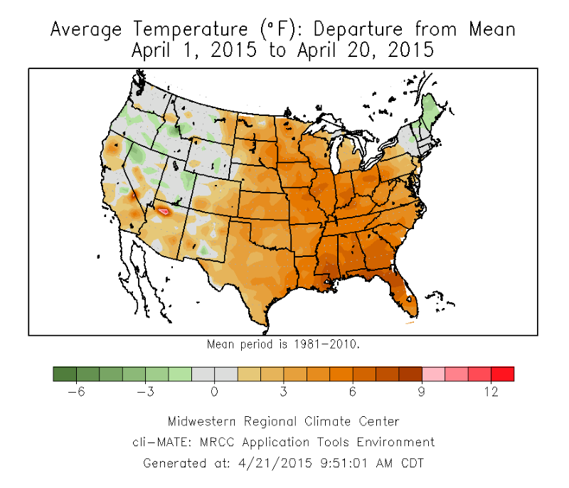
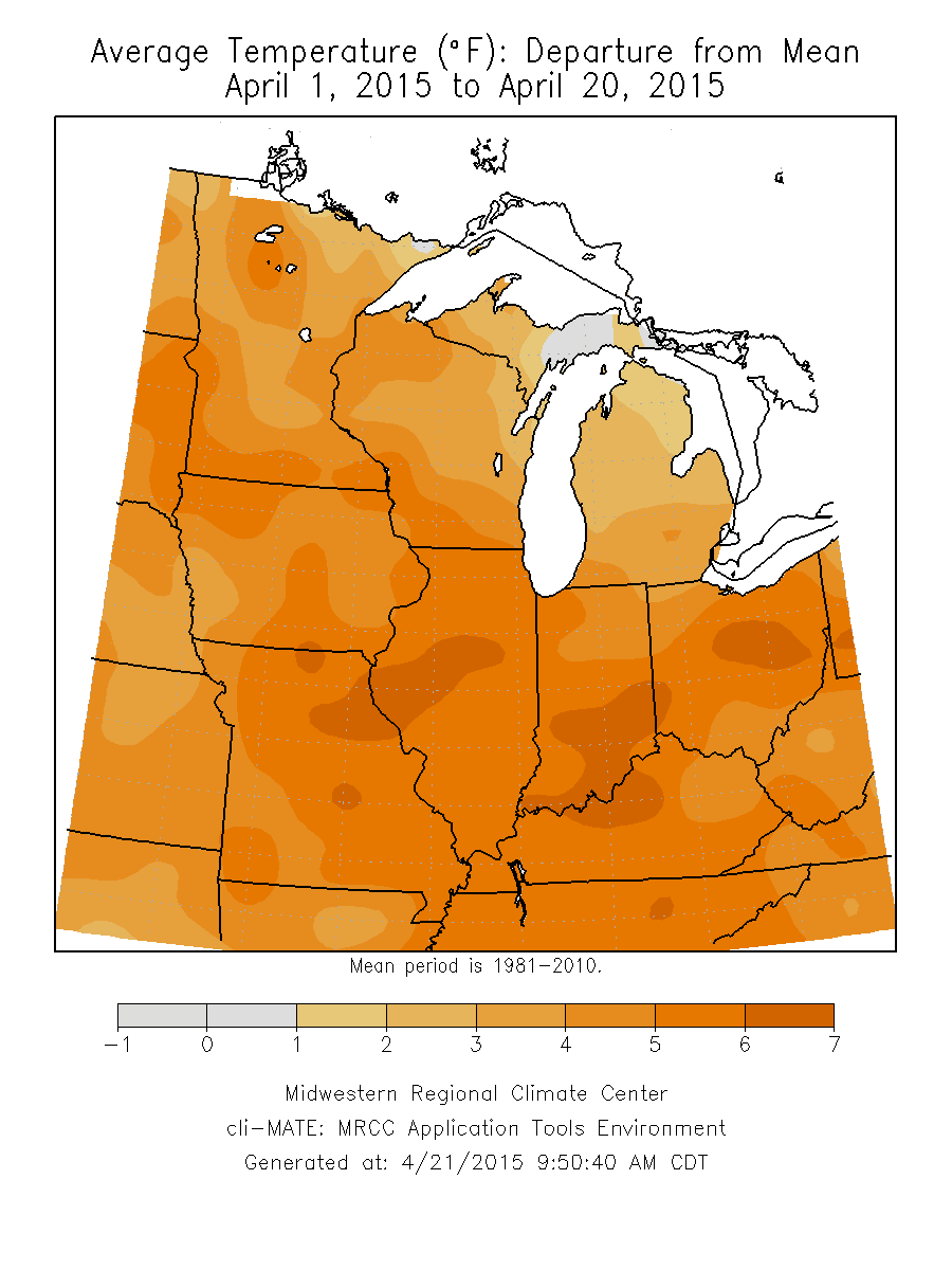
Here are maps showing how April so far has been warmer and wetter than average across Illinois and the Midwest.

Temperature Departure from Average

Right now, most of the eastern two-thirds of the United States have experienced above-average temperatures for April (first map). The Midwest has been 1 to 6 degrees above-average, depending on the shade of orange (second map). Click on any map to enlarge.

map4

map3
Precipitation Departure

Continue reading “April Weather – Warm, Wet Across Illinois and Midwest”

NWS Outlook for the Growing Season in Illinois

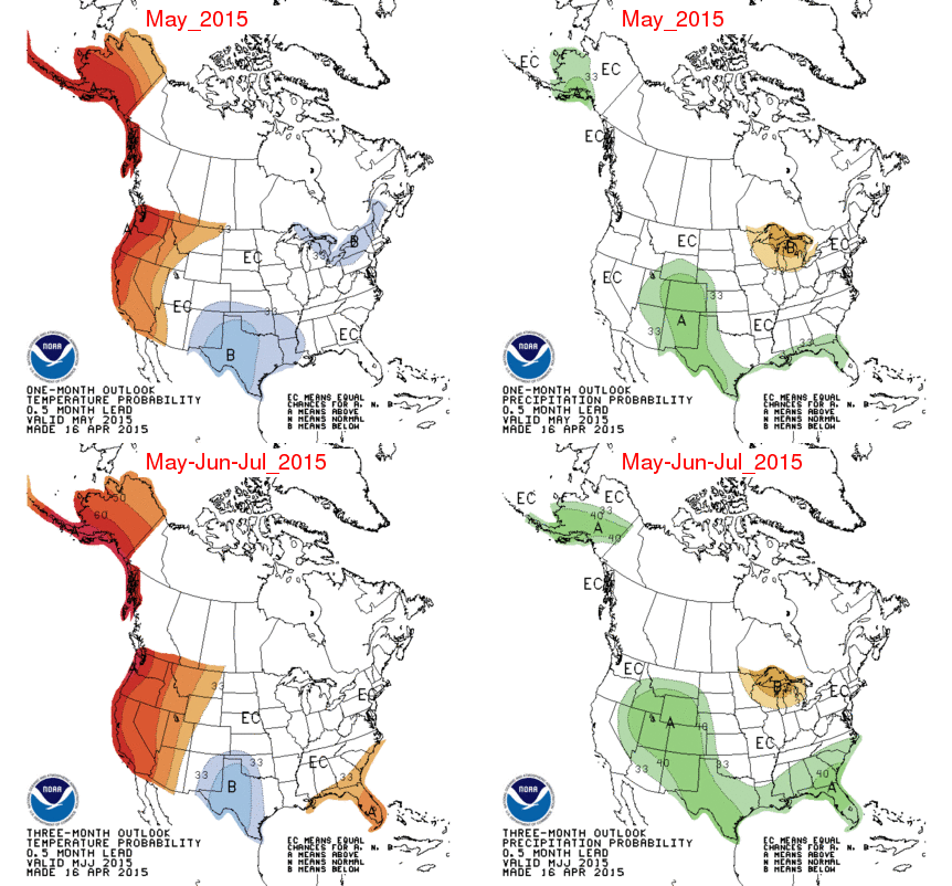
The NOAA Climate Prediction Center has released their monthly and seasonal outlooks for the growing season.

In the near-future, the 6-10 and 8-14 day forecast indicate that colder-than-average conditions will prevail for the next two weeks. For precipitation, there is an increased chance of drier-than-average conditions in parts of northern Illinois for the next two weeks.

There is not a lot to report for Illinois at the medium range. We are in equal chances (EC) for above-, below-, and near-average temperature and precipitation for both May and the 3-month period of May-July.

page2

Continue reading “NWS Outlook for the Growing Season in Illinois”

April EF-4 Tornadoes Rare in Illinois

According to the National Weather Service report on the April 9, 2015, tornadoes, the tornado that tracked through Fairdale was rated EF-4 on the Enhanced Fujita scale. This would be the first EF-4 tornado in April since 1981 for Illinois and only the 33rd in Illinois history, regardless of month, since reliable records began in 1950.

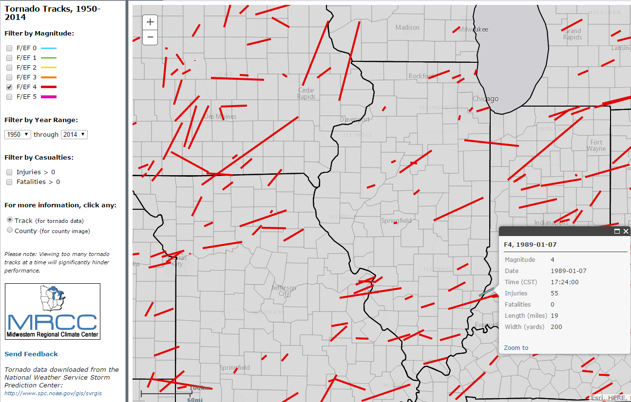
According to the NWS Storm Prediction Center database, only 33 F/EF-4 tornadoes have struck Illinois since 1950. Even more rare, only 8 have hit Illinois in April. Of those eight in April, six struck in the 1960s, one in 1981, and one in 2015:

Here are all the F/EF-4 tracks for Illinois from 1950-2014, from the MRCC tornado tracker tool. Unfortunately, we cannot screen out just the April events at this time. While this is a screenshot of the tool, the actual tool allows you to zoom in and out. If you point to a track then you get a pop up window with the details of that track. Check out the tornado tracker tool – it’s free.

f4