

The Water and Atmospheric Resources Monitoring Program (WARM), monitors water table levels at several wells across the state. Continuous, daily measurements have been made at many of these stations since the mid-1990s. This relatively long record of shallow groundwater is an important resource for us here in Illinois, and helps us understand the severity and extent of extremes such as drought, and human-caused groundwater depeletion.
More information on WARM and shallow groundwater monitoring program is available here.
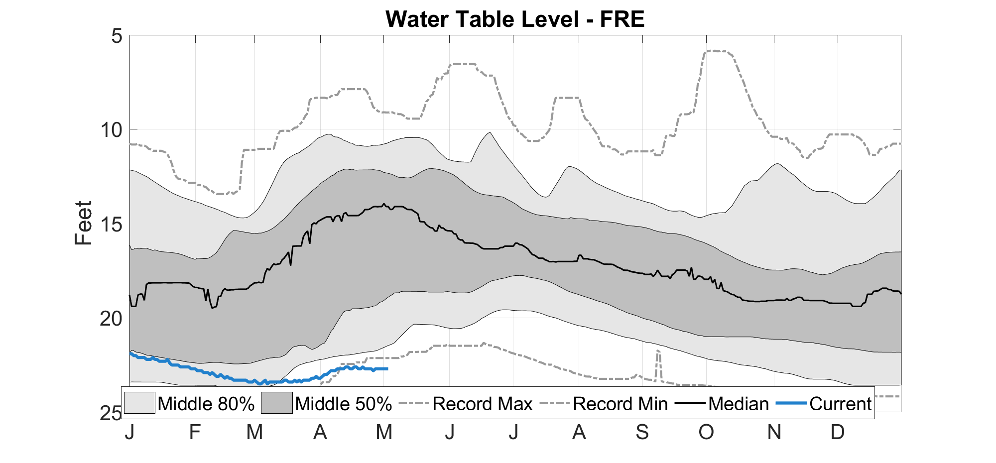
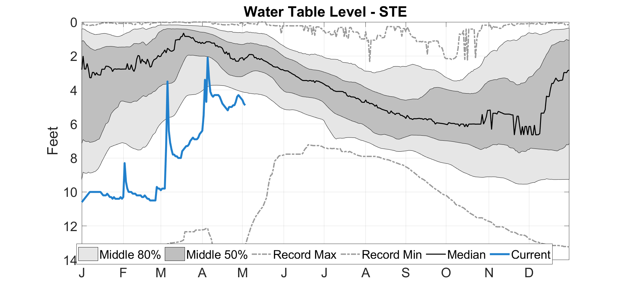
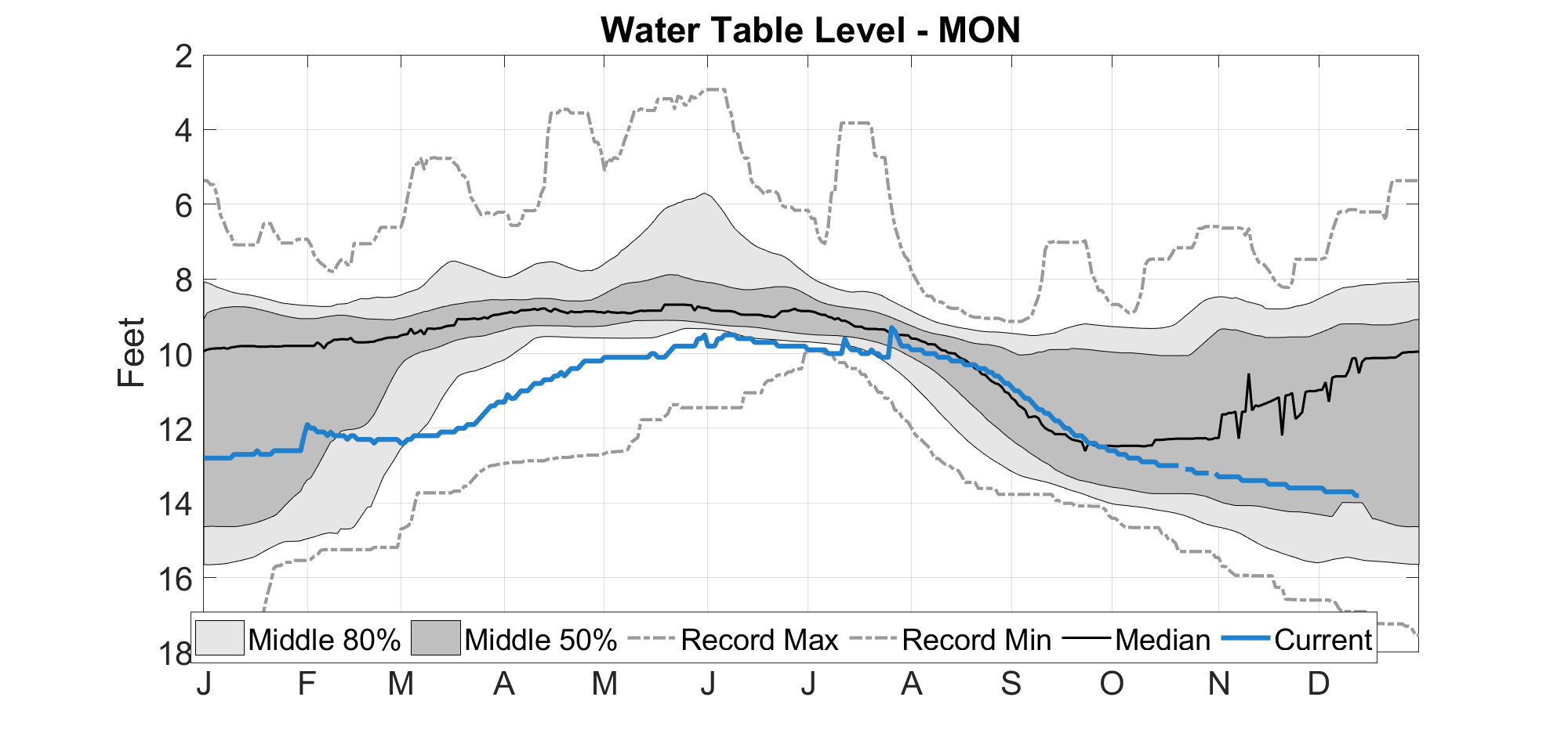
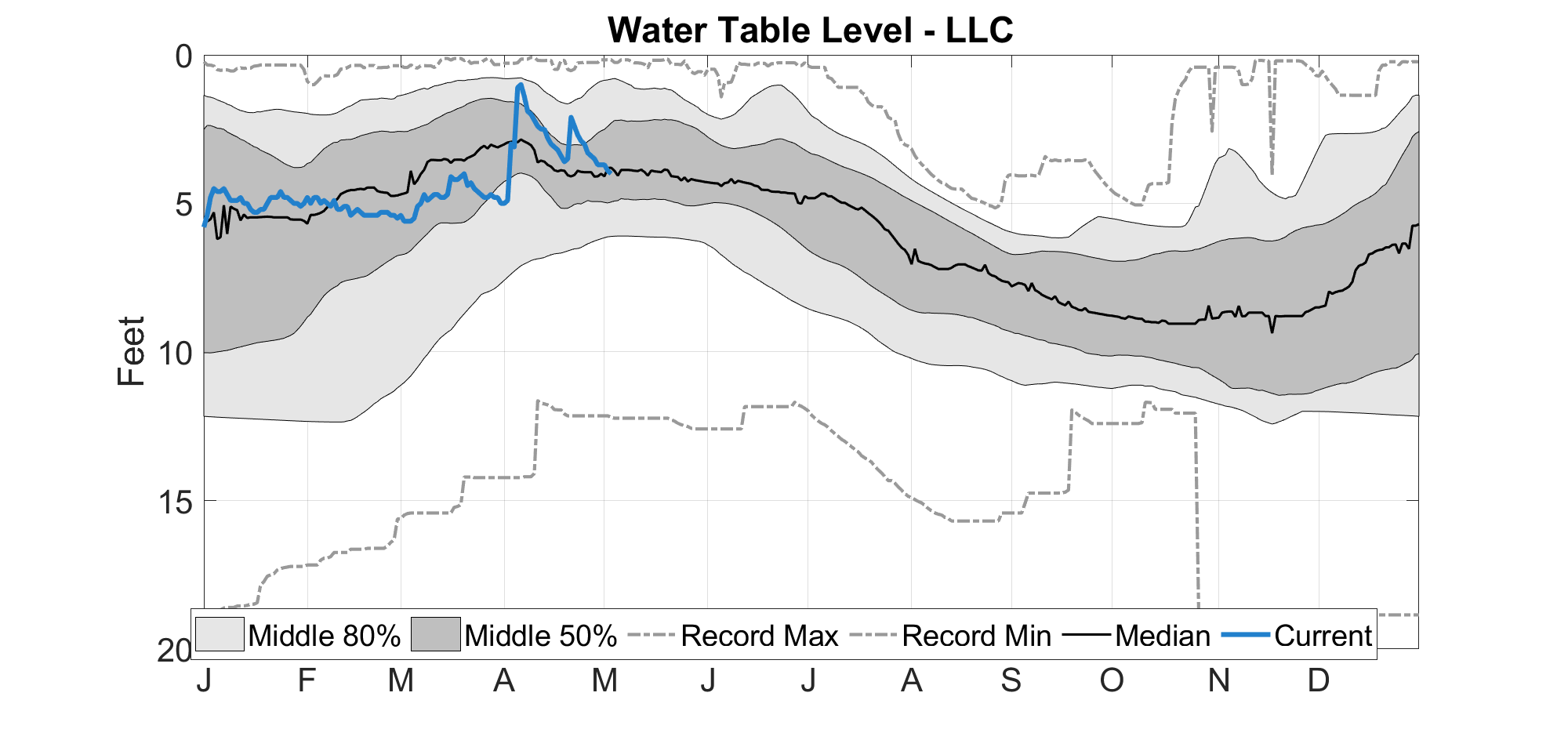
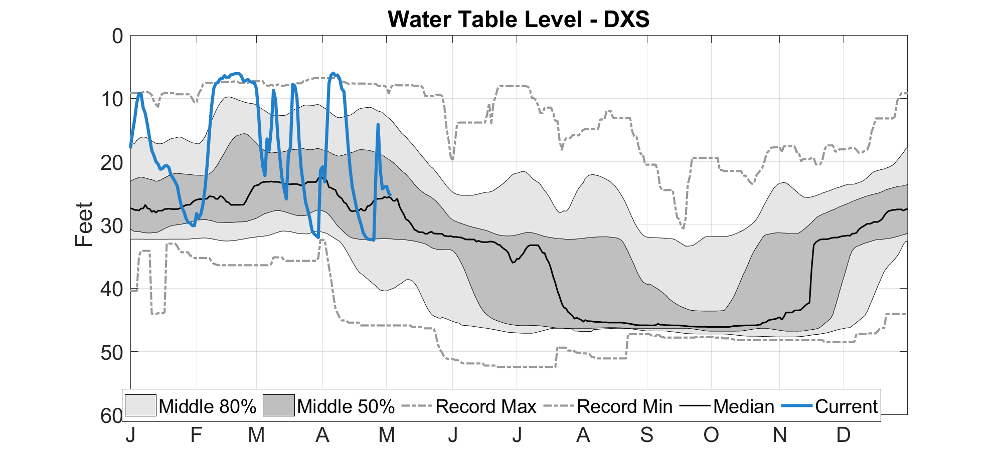
The figures in the links below show current water table levels at multiple WARM sites. The blue line in the figure shows the current depth to water table (in feet), the light gray area shows the historical range between the 10th percentile (i.e., very shallow) and 90th percentile (i.e., very deep) for each calendar day. The dark gray area shows the historical range between the 25th percentile and 75th percentile for each calendar day, and the dashed gray lines show the historical minimum and maximum water table depth for each calendar day.