
As part of the Water and Atmospheric Resources Monitoring Program (WARM), the Illinois Climate Network monitors soil moisture conditions at several stations across the state. Continuous, hourly measurements have been made at many of these stations since the early 2000s. This relatively long record of soil moisture is an important resource for us here in Illinois, and helps us understand the severity and extent of extremes such as drought and saturation (flooding).
More information on WARM and the ICN soil moisture monitoring program is available here.
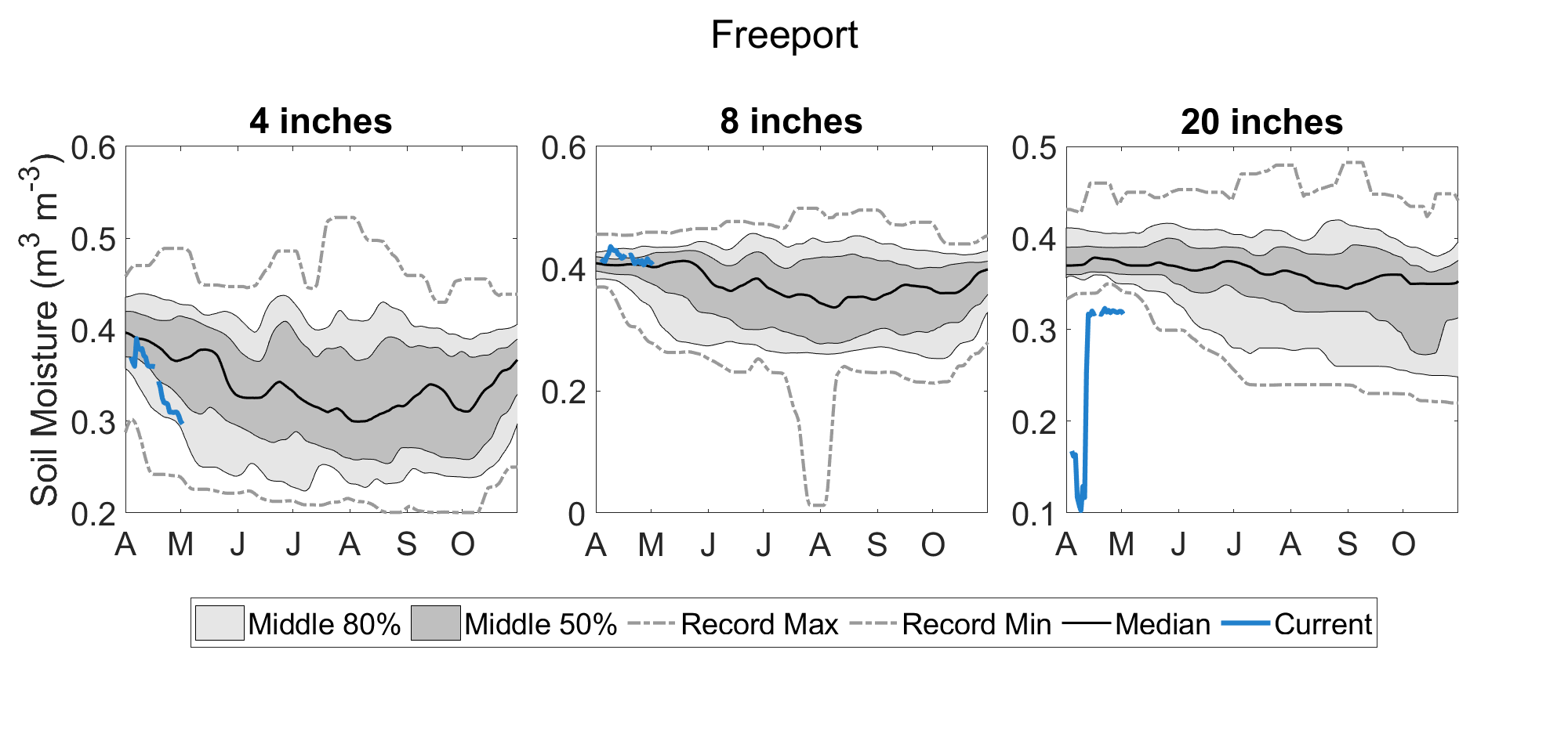
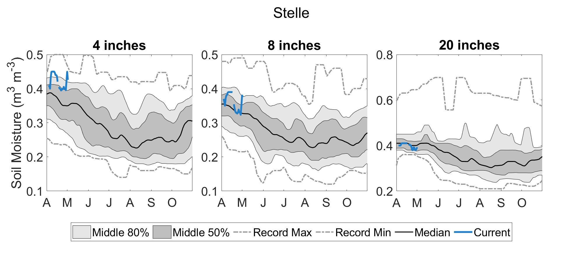
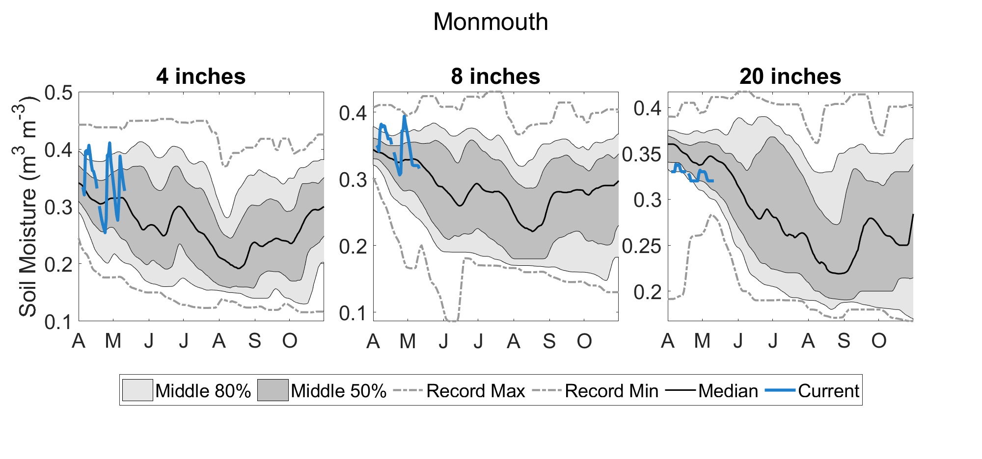
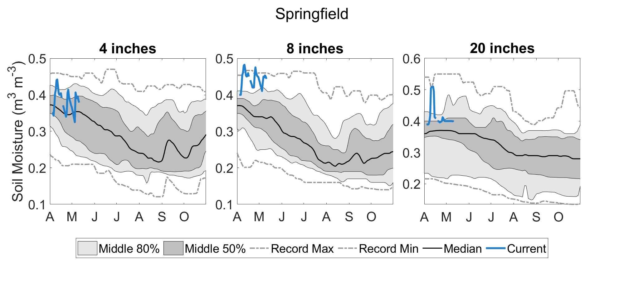
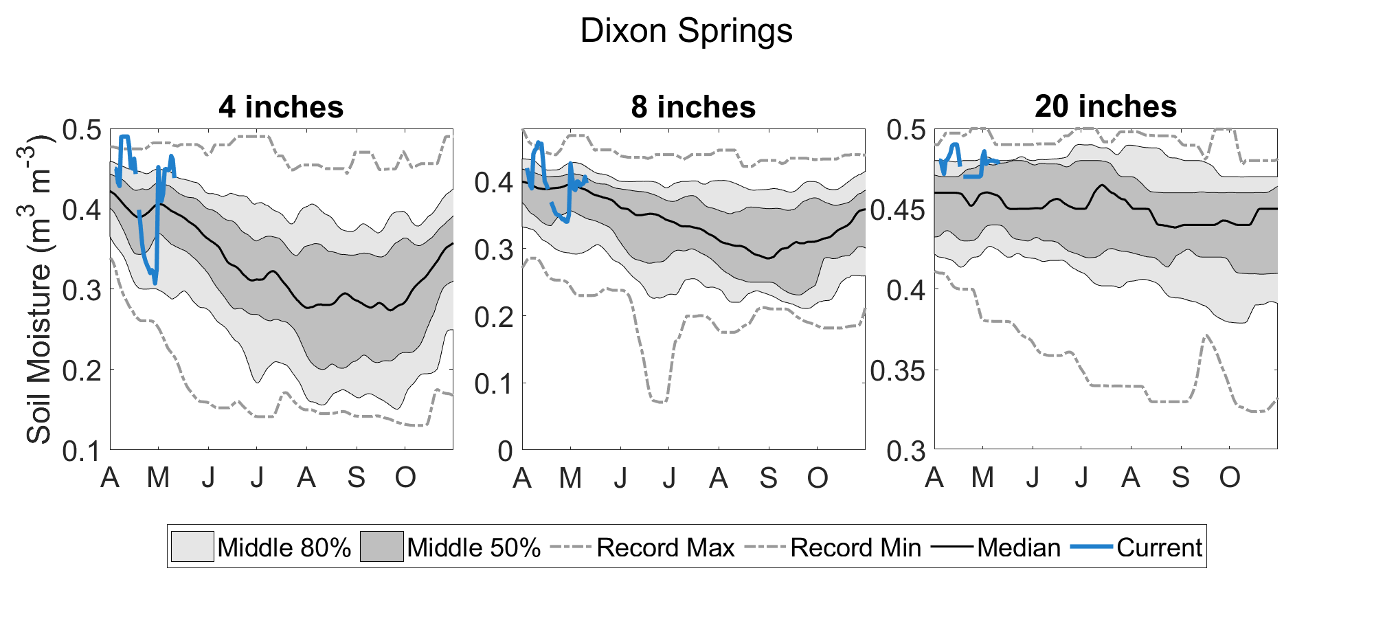
The figures in the links below show current soil moisture, updated at the beginning of each day, at multiple Illinois Climate Network stations. The blue line in the figure shows the current soil moisture in volumetric water content, the light gray area shows the historical range between the 10th percentile (i.e., very dry) and 90th percentile (i.e., very wet) for each calendar day. The dark gray area shows the historical range between the 25th percentile and 75th percentile for each calendar day, and the dashed gray lines show the historical minimum and maximum soil moisture condition for each calendar day.