Wild Weather in Chicago Area

The severe thunderstorms that swept though Chicago on July 11, 2011, caused widespread damage. Here are the maps and initial reports of damages from the NOAA Storm Prediction Center. The wind damage was common throughout Chicago, as well as parts of southeastern Wisconsin, Indiana, and Michigan.
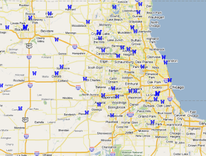
Some parts of the Chicago area received up to 0.75 inches of rain from this event, according to the reports from the Community Collaborative Rain, Hail, and Snow  network (CoCoRaHS). See last map below.

Summary of Damage Reports (PDF)
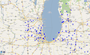
Storm Reports for July 11
Storm Reports for July 11, 2011, for the Midwest. Click to enlarge.

Storm Reports for July 11
Storm Reports for July 11, 2011, for the Chicago area. Click to enlarge.

July 11 rainfall
July 11, 2011, rainfall from the CoCoRaHS network (cocorahs.org). Click to enlarge.

Maps for July 2010

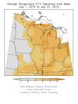
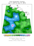
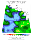
Here are the thumbnail maps (click to enlarge) of July temperature departures, and July rainfall and rainfall departures. It was warmer than normal across much of eastern Corn Belt. It was much wetter than normal across much of the western Corn Belt.

July temperatures in the Midwest
July temperature departures from normal for the Midwest.

July rainfall in the Midwest.

July rainfall departures for the Midwest.
July rainfall departures from normal for the Midwest.

July – Warmer and Wetter than Normal

The average temperature for July in Illinois was 77.7 degrees, 1.9 degrees above normal. That’s warm but not record-breaking by any means. By contrast, the average temperature of last July was 70.2 degrees. Not only was this year warmer but it was considerably more humid as well.
The average rainfall for July in Illinois was 5.6 inches, 1.8 inches above normal. BTW, the wettest July on record was 1958 with 8.03 inches.
The largest rainfall totals occurred in western and far northern Illinois as well as an area along I-70. Amounts of 8 to 12 inches were common in these areas.
Southern Illinois was much drier in July with amounts of only 1 to 3 inches in many locations. In fact, the US Drought Monitor categorized southern Illinois as being “abnormally dry” by. Another area of dryness is through central Illinois in an area bound by Moline, Kankakee, Danville, Springfield, and Peoria.

Rainfall Totals for July in the Chicago Area

Here are some rainfall totals for July 2010 [updated on August 3] for the Chicago area. This is preliminary and may contain missing or incorrect data. Missing data can make the monthly totals too low.  Based on what has been reported so far, Midway Airport has set a new record for July precipitation, beating the old record of 8.98 inches set in 1957.

Monthly Data for July 2010 for Illinois – Northeast Climate Division
Station Total Precipitation
BARRINGTON 3 SW 7.18
BELVIDERE 7.24
CHICAGO BOTANICAL GARDEN 5.51
CHICAGO MIDWAY AP 10.39
CHICAGO MIDWAY AP 3 SW 9.17
CHICAGO OHARE INTL AP 8.84
DE KALB 6.92
EARLVILLE 3 S 3.31
ELBURN 6.28
ELGIN 7.68
GENOA 2 SW 8.89
GLEN ELLYN 4 S 7.48
HARVARD 9.52
JOLIET BRANDON RD DM 5.00
MARENGO 6.53
MARSEILLES LOCK 3.87
MCHENRY STRATTON L 3.28
MENDOTA 2 SE 3.29
MONEE RSVR 6.01
MORRIS 3.89
MUNDELEIN 4 WSW 7.06
NEWARK 2 SSE 3.91
OAK BROOK 2W 9.02
PARK FOREST 6.38
PERU 2.74
PLAINFIELD 3 NE 7.48
ROMEOVILLE LEWIS UNIV AP 8.05
SHABBONA 3S 5.29
SPRING GROVE 6.89
ST CHARLES 7 NW 9.44
STREAMWOOD 6.91
WHEATON 3 SE 6.25
WOODSTOCK 5 NW 6.65
YORKVILLE 3 SW 4.31