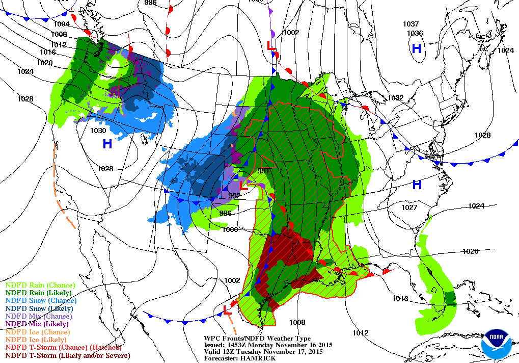
The rain has finally moved into Illinois this morning. According to the National Weather Service, widespread heavy rain is expected to continue in Illinois over the next 3 days. Here is the forecast map for Tuesday morning showing a large storm moving across the central US. Rain is likely from the Gulf of Mexico all the way up to the western Great Lakes. Snow is likely in the Plains states (areas in blue). However, we will likely be too warm in Illinois to see snowfall.
Now You See It – Now you Don’t, Drought Monitor Removes D0 in Illinois
There is an inside joke for those of us who work with the folks at the US Drought Monitor. If you want to make it rain (or snow), just put an area in D0 “abnormally dry” and the heavens will open up. That’s basically what happened this week – the rain and snow in Illinois reduced the concern of dry conditions across the state. As a result, the D0 in northern and western Illinois has been removed.
By the way, it is a lot easier to move in and out of “abnormally dry”. It becomes increasingly difficult to recover from drought as you increase the intensity and duration of the drought.
Monthly Temperature and Precipitation Departures Since 2011
Here are the monthly temperature and precipitation departures for the state of Illinois since 2011. Departures are from the long-term average (1981-2010). A few of the outstanding features were:
- outstanding warming from July 2011 to July 2012;
- a wet start to 2011 and 2013;
- drought in 2012, starting in January 2012 and staying in parts of Illinois through at least the end of the year.
Before becoming too complacent about growing conditions this summer, we should remember that we started out with wet conditions in 2011 before a flash drought arrived in July and August. The combination of hot, dry conditions – especially in central Illinois – led to crop losses by the end of August of that year.
Temperatures and Precipitation By Month in 2013
Here are the monthly temperature and precipitation departures from the long-term average by month in Illinois for 2013. After a warmer-than-average January, temperatures have been below-average in February, March, and April. Monthly precipitation has been above-average in January, February, and April, but slightly below-average in March.
This is a far cry from the first four months of 2012 which were noteworthy for being both above-average on temperatures and below-average on precipitation. See the second pair of figures for 2012.