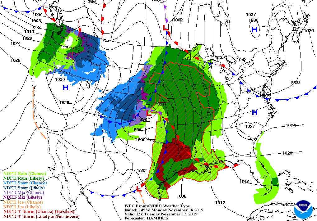
The rain has finally moved into Illinois this morning. According to the National Weather Service, widespread heavy rain is expected to continue in Illinois over the next 3 days. Here is the forecast map for Tuesday morning showing a large storm moving across the central US. Rain is likely from the Gulf of Mexico all the way up to the western Great Lakes. Snow is likely in the Plains states (areas in blue). However, we will likely be too warm in Illinois to see snowfall.
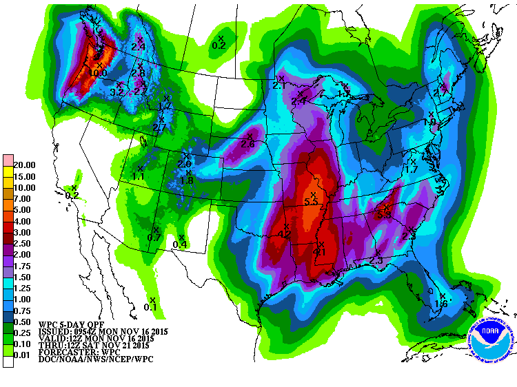
The second map shows the precipitation potential over the next 5 days. Areas in red including southern and western Illinois have the potential of receiving 3 to 5 inches of rain. Areas in northern and eastern Illinois have the potential of receiving 1.75 to 3 inches of rain. The NWS has already issued flood warnings and watches for most of Illinois. Needless to say, if the rainfall totals are anywhere near what is expected, concerns of drought in Illinois after the dry fall will be washed away.