
The 2023 drought has been the most extensive and intense in Illinois in the last 10 years. In mid-July, two-thirds of the state was in at least moderate drought, which caused significant impacts to crops, ecology, streams and rivers, and lake levels. Fortunately, most of the state has been considerably wetter since mid-July, providing some relief to drought conditions.
Recent Rainfall
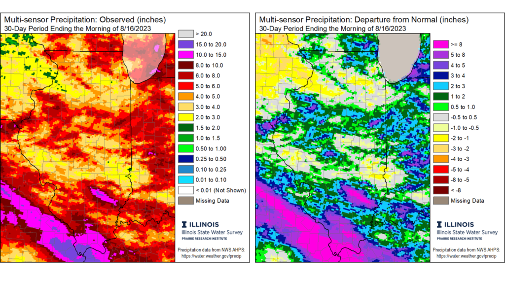
Most of the state saw near to much wetter than normal conditions since mid-July (Figure 1). Isolated spots of central Illinois and virtually all of far southern Illinois was 5 to 8 inches wetter than normal over the past 30-days, while much of central and northeast Illinois were 1 to 3 inches wetter than normal. Some parts of northwest and central Illinois remained 1 to 2 inches drier than normal since mid-July, but the combination of at least some rain and mild temperatures helped reduce drought extent and severity statewide.
The recent wetter conditions have helped improve drought extent and severity. The August 15th US Drought Monitor map shows only 15% of the state in at least moderate drought, down from 65% in mid-July and over 90% in late June (Figure 2). The quick improvement in the Drought Monitor over the past 4 weeks matches the rapid onset of this year’s drought between that was driven by a very dry June.

Heat and Dryness on the Way
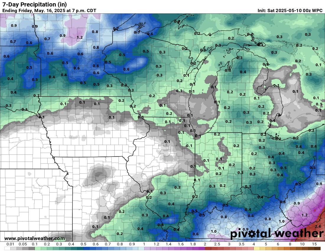
Soil moisture has increased substantially across the state in the first half of August. Having plant available water in the soil will be particularly improvement as we head to a period of very hot and dry weather in Illinois. The 7-day Weather Prediction Center forecast shows very little, if any rain coming to Illinois through August 24 (Figure 3). The dryness is due to a very large area of high pressure that will likely set-up in the central US. The big weather change will also bring in much higher temperatures, with daily highs possibly in the mid- to upper-90s for several days. The combination of dry and hot weather will stress crops and ecology, which is why our wetter soils are so important moving into next week.
It’s important to note that some parts of the state have not seen as much improvement since the beginning of August, and we’ll likely see drought impacts worsen in those places next week.
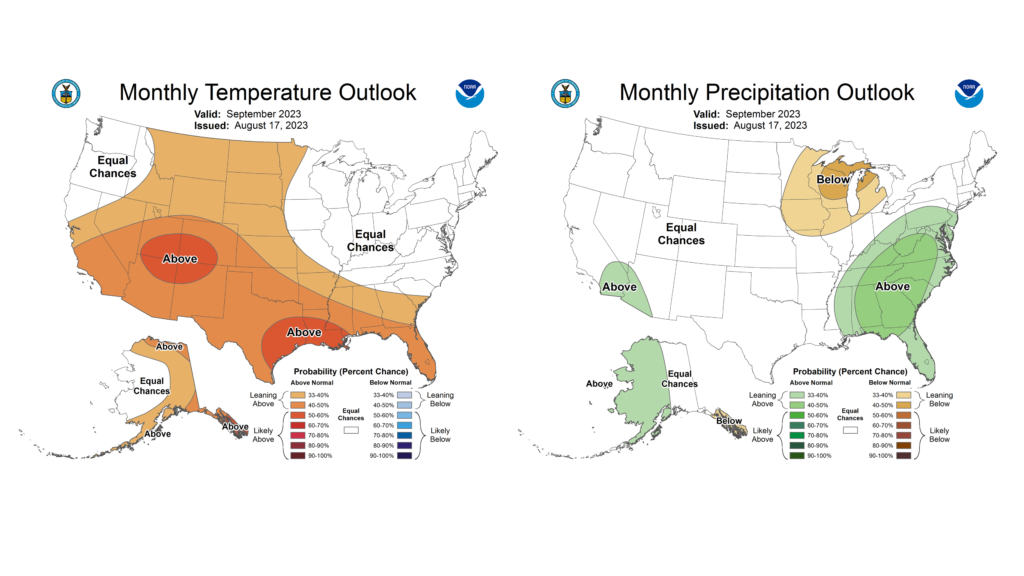
Beyond next week, the latest Climate Prediction Center outlooks show higher chances of drier than normal conditions in northern Illinois and much of the Upper Midwest carrying over into September (Figure 4). September and October tend to be the time of the year with the overall lowest streamflow on large rivers such as the Mississippi and Illinois. Recent rain has greatly improved streamflow conditions along these and other rivers, but a potential shift to drier conditions in the Upper Mississippi basin could increase the risk of low-flow conditions south of St. Louis or Cairo moving into fall. This is something to watch as we move into September.
As we move ahead into a hot and dry week, and farther out as summer transitions to fall, it is very important to continue monitoring and reporting drought conditions and impacts. Folks should continue reporting what they’re seeing from drought using the Condition Monitoring Observer Reporting (CMOR) system: go.illinois.edu/cmor.