Monthly Temperature and Precipitation Departures for Illinois in 2015

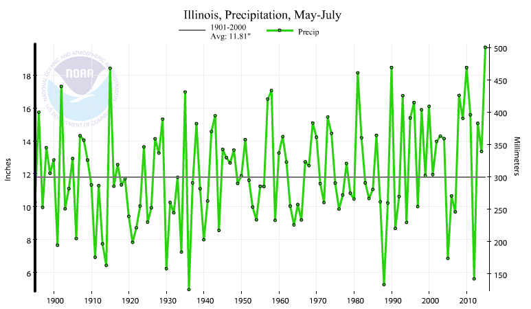
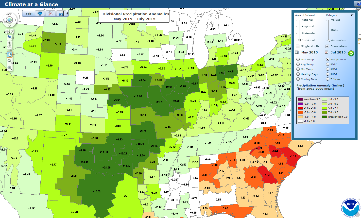
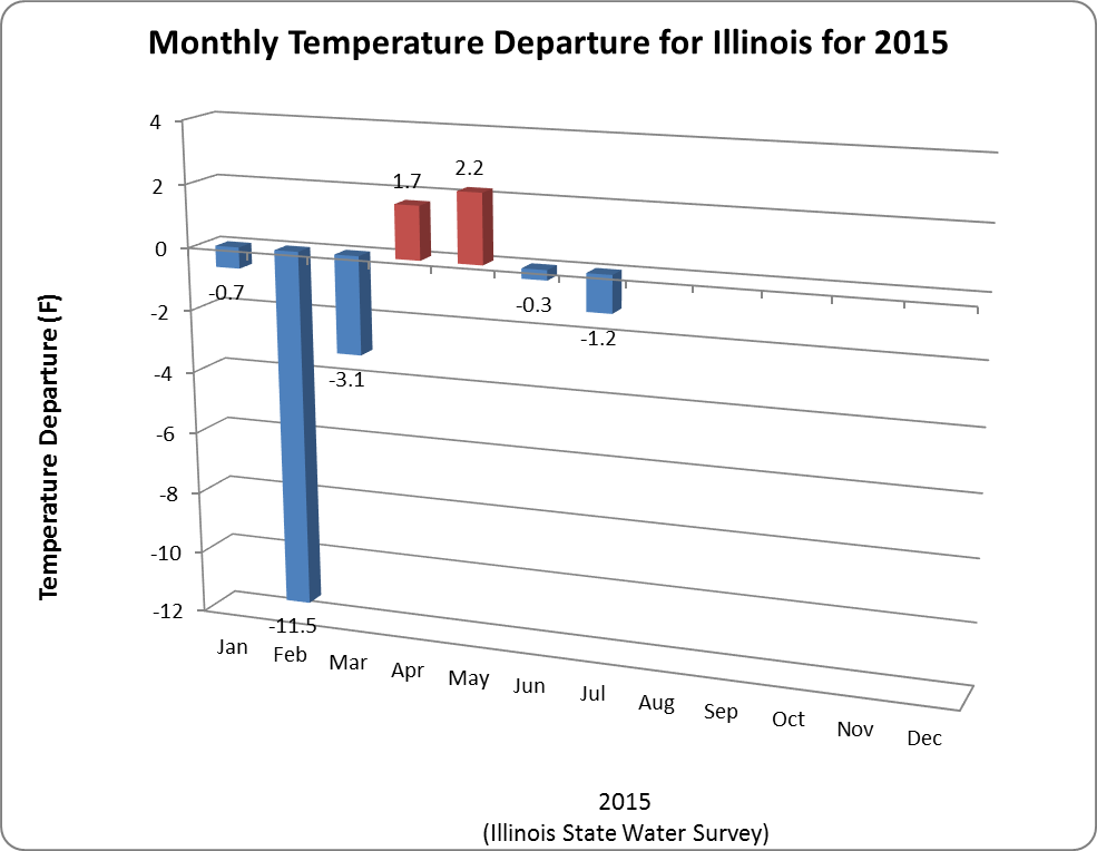
Here are the statewide monthly temperature and precipitation departures for Illinois in 2015. The departures are from the 1981-2010 averages.

The standout features of 2015 so far have been:

  1. the very cold February, 19.4 degrees, and tied with 2014 as the 8th coldest February on record;
  2. the very wet June, 9.44 inches of precipitation and the wettest June on record.

Statewide records go back to 1895 and are maintained by the National Centers for Environmental Information.

Temperatures. Click to enlarge.

Continue reading “Monthly Temperature and Precipitation Departures for Illinois in 2015”

Wettest May – July on Record for Illinois

Illinois experienced its wettest May – July on record with 19.69 inches of precipitation, 7.88 inches above the 20th century average, according to the National Centers for Environmental Information. Most of that was due to the record precipitation of June with 9.44 inches statewide, based on their latest numbers and discussed in more detail here.

Here is the time series of May – July precipitation in Illinois since 1895. The second wettest May – July was a tie between 1990 and 2010. And it was just three years ago, in 2012, when Illinois had its third driest May – July on record with only 5.60 inches (6.21 inches below the 20th century average).

May-July precipitation in Illinois. Click to enlarge.

Here is what the May – July 2015 precipitation departures from the 20th century average looked like for climate division in Illinois and surrounding states. That is about an extra two months of precipitation during that three-month period.

Click to enlarge.
Click to enlarge.

Forecast for August: Remaining Cooler for Illinois

Illinois has an increased chance of being cooler-than-average for August, according to the NWS Climate Prediction Center. The new forecast was released on July 31, 2015.

One of the major drivers in the forecast is that we are currently in an El Niño event. Historically, August temperatures tended to be cooler than average during El Niño events.

This forecast of a cooler August follows on the heels of our cool July. Besides El Niño, in the past the temperature pattern experienced in July has a tendency to carry over into August. That is a hot July tends to carry over to a hot August and a cool July tends to carry over to a cool August.

This is largely the result of soil moisture status. Dry soils in July (i.e., drought) leads to warmer temperatures in both July and August. On the other hand, wet soils in July hold down August temperatures as more solar radiation goes into evaporating and transpiring water back into the atmosphere and less into heating up the atmosphere.

Click to enlarge.
Click to enlarge.

Continue reading “Forecast for August: Remaining Cooler for Illinois”