January – Wild Temperature Swings and Dry

Summary: January in Illinois finished out at 26.7 degrees, 0.3 degrees above average. Both precipitation and snowfall were below average. The statewide average precipitation (rain plus water content of snow) was 0.85 inches, 1.22 inches below average. Snowfall was below average across most of the state.

Temperature

The temperatures in January in Illinois showed some very large swings that tended to cancel each other out in the end since we finished 0.3 degrees above average. The first 9 days were above average, followed by 4 days below average, then 3 days above average. The second half of January started out much below average, but steadily warmed and by the end of the month was 20 degrees above average.

While the magnitude of the swings were impressive, the pattern of warm and cold stretches is typical of winter in Illinois and represents the passage of warm and cold fronts across the region. Because it may take a day or more for a system to pass through Illinois, the dates and size of the temperature departures at a particular station may not correspond to the statewide numbers, especially in far southern Illinois.
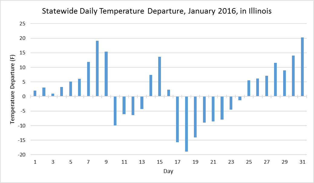
image001

Precipitation

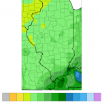
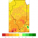
The January precipitation (left) and departures from average (right) show that precipitation was uniformly light across Illinois, just under an inch in most places (light green) and just over an inch below average (shades of yellow).

Snowfall

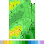
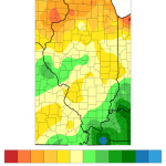
The January snowfall (left) ranged from 2 to 5 inches in most locations. Western Illinois saw 5 to 7.5 inches. However, as the panel on the right indicates most of Illinois received below-average snowfall (shades of beige and yellows).
Snowfall for November 20-22, 2015

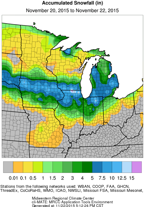
The winter storm over the weekend left a narrow swath of significant snowfall across the central Midwest. The heaviest amounts of 5 or more inches (blue) extended from the High Plains through Iowa, northern Illinois, southern Wisconsin, northern Indiana, and Michigan.

map1

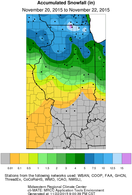
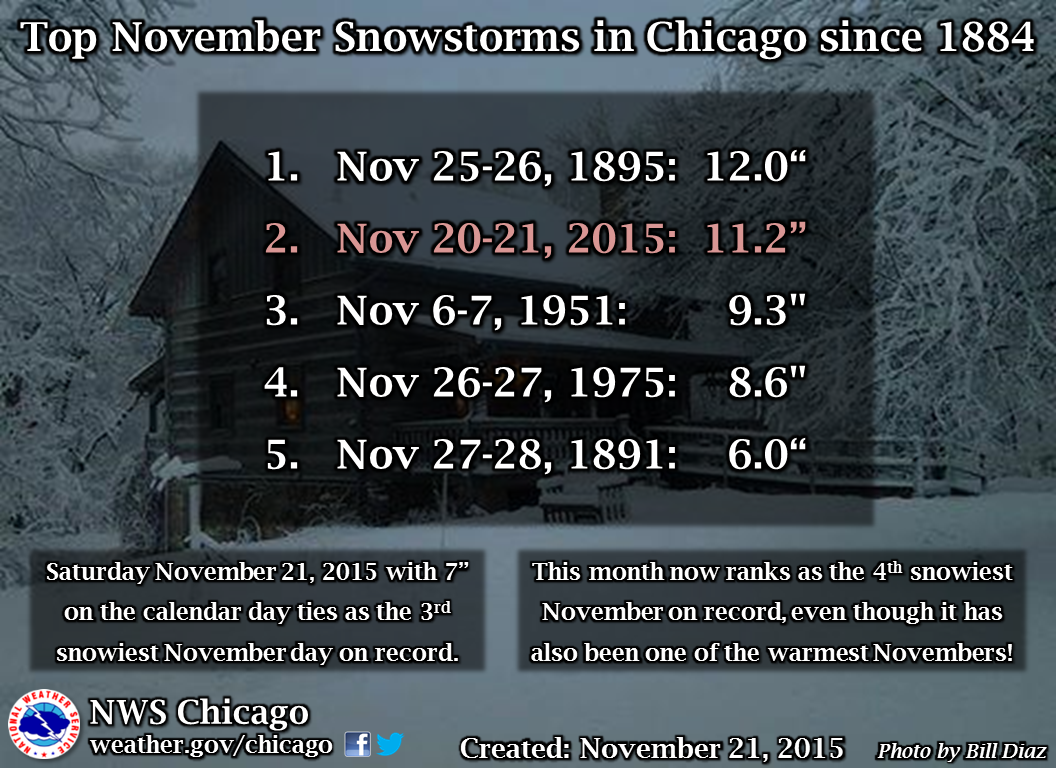
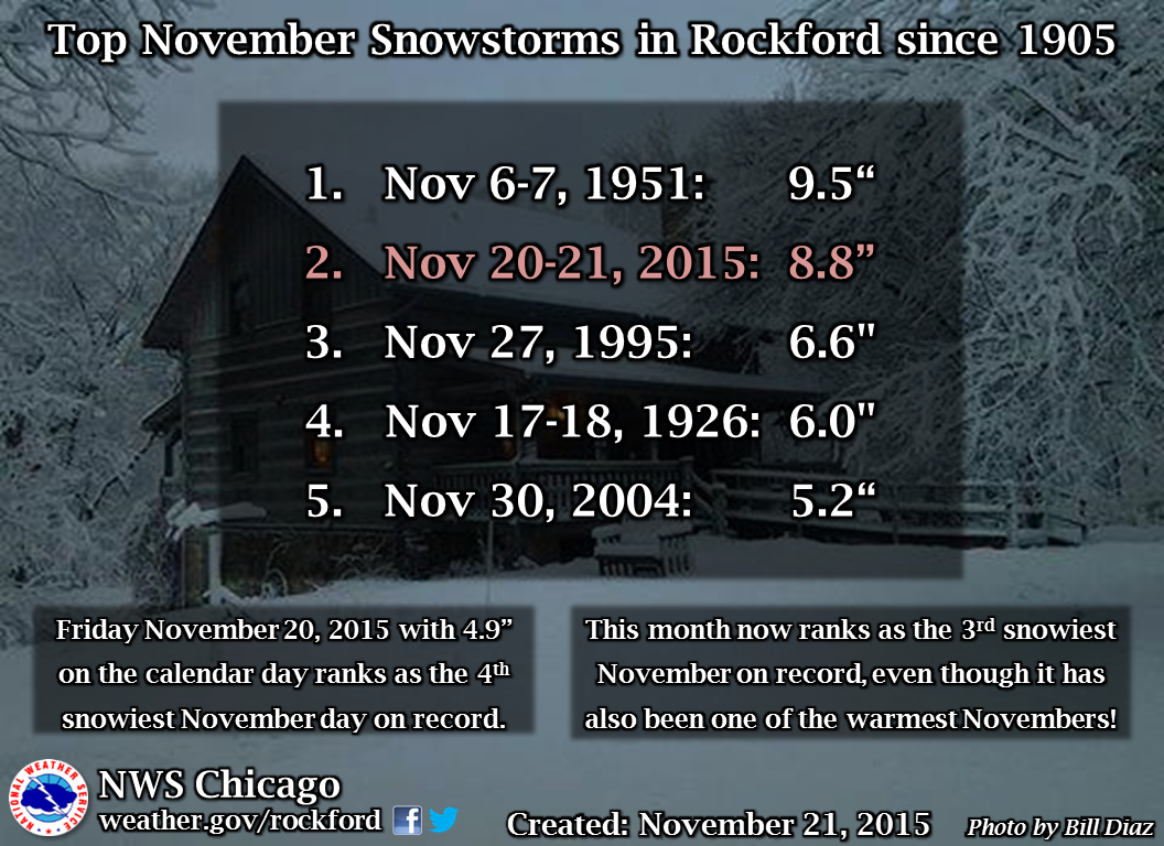
Here is a close-up of Illinois. The largest amounts are along the Illinois-Wisconsin border. Amounts of 5 inches or more (blue) were common across the northern third of the state. The largest snowfall totals in Illinois was 17.1 inches at Roscoe (Winnebago Co.) followed closely by 16.9 inches in Mundelein (Lake Co.). It was the second largest November snowfall for both Chicago (11.2 inches) and Rockford (8.8 inches). See graphics below created by NWS Chicago.

Snowfall amounts tapered off southward, decreasing rapidly from 5 to 1 inches (green), and south of Interstate 70 was essentially snow-free.

map2

ChicagoNovSnowstormsRockfordNovSnowstorms

A Weak El Nino Has Arrived, Another Winter Storm for Southern Illinois

1680v1_20150305-ElNino_arrives_1200
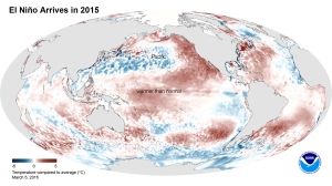
El Niño Arrives in 2015. This image shows the average sea surface temperature for February 2015 as measured by NOAA satellites. The large area of red (warmer than average) can be seen extending through the equatorial Pacific. (Credit: NOAA)

Today the National Weather Service reported that the long-awaited El Niño has arrived in the Pacific Ocean. El Niño occurs when we have above-average temperatures in the Pacific Ocean along the equator. It alters the Pacific weather pattern, which in turn alters our weather patterns over the US. The NWS forecasters say “it is likely (50 to 60 percent chance) that El Niño conditions will continue through summer. ” Due to the weak nature of this event, they are not expecting widespread or strong impacts from this event.

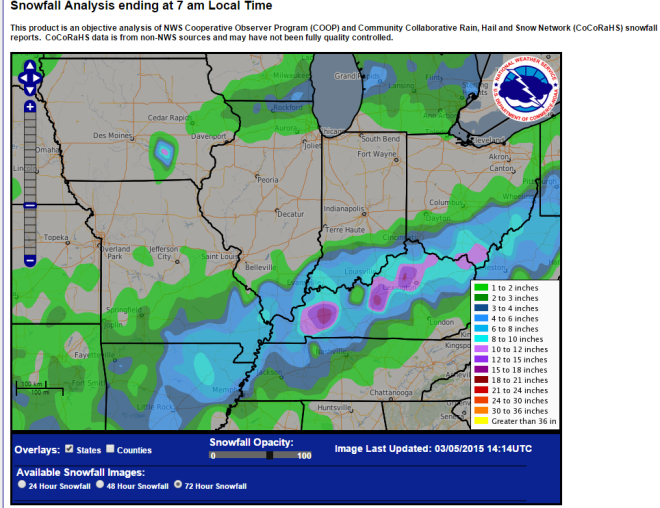
In other news, far southern Illinois was hit this week with another winter storm that passed through Arkansas; southeastern Missouri;  southern Illinois, Indiana, and Ohio; as well as most of Kentucky and points beyond. Some of the largest snowfall totals from this event include Grand Chain Dam with 10.0 inches and Brookport Dam with 9.0 inches.

snow-south

Winter Finishes Cold and Snowy in Illinois

The statewide average temperature for the three winter months of December, January, and February in Illinois was 26.1 degrees, 7.5 degrees below average. While cold, it was not nearly as cold as last winter’s 21.7 degrees. This winter ranks as the 30th coldest on record.

winterThis winter started off mild with an average December temperature of 33.9 degrees, 4 degrees above average.  The average temperature in January was 25.7 degrees, only 0.7 degrees below average, and the average in February was 18.6 degrees, 12.3 degrees below average. See figure to the left, click to enlarge. Last winter, all three months were well below average.

Snowfall

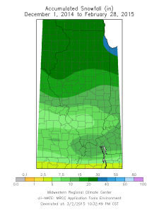
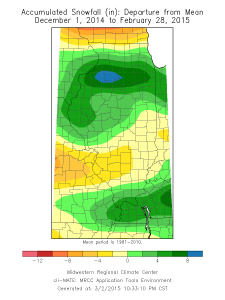
Snowfall was above average for the winter from December through February. Most of that fell in February. December was snow-free for most of the state except in the far west. Snowfall was common in January but below average except for a band across northern Illinois. Major snows occurred in February to bring up the winter snowfall totals across the state. Above-average snowfall occurred across northern and western Illinois as well as far southern Illinois. The maps below show the observed amounts and departure from average.

map2map3

Precipitation

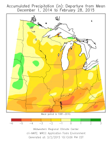
map1The average precipitation for December-February was 4.97 inches, 1.85 inches below average. In fact, most of the Midwest received below-average precipitation this winter (figure left). Precipitation is a measure of both rainfall and the water content of any snow. While we received above-average snowfall, the water content of that snow was not always great. In a typical year we can get rain in winter, but not so much this winter. This kind of precipitation deficit would be a concern during the growing season. However, in winter the water demand is low.