The preliminary statewide average May temperature was 63.0 degrees, 0.2 degrees below the 1991–2020 average and the 58th warmest on record going back to 1895. The preliminary statewide average total May precipitation was 3.75 inches, 1.02 inches below the 1991–2020 average and the 55th driest on record statewide.
Data are provisional and may change slightly over time
The first four months of 2025 collectively were just under 1 degree warmer than normal statewide. May temperatures likewise varied within 1 degree of normal statewide, with periods of much warmer and much cooler weather during the month (Figure 1). Daily temperatures and temperature departures from normal in Charleston are shown in Figure 1, illustrating the typical temperature variability in May. Temperatures reached into the upper 80s to low 90s statewide around mid-month before dropping to 10-15 degrees below normal a week later.

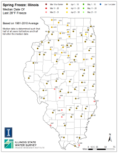
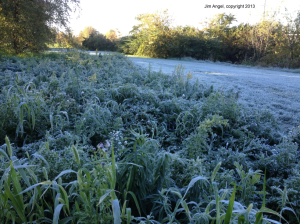
May average temperatures ranged from the mid-50s in northern Illinois to the high 60s in southern Illinois, within 1 degree of normal virtually statewide (Figure 2). Several stations saw their first 90+ degree temperatures last month, including a daily record breaking 94 degrees at Chicago’s O’Hare Airport on May 15. Meanwhile, the state was largely spared a late spring freeze in May, with only a handful of stations experiencing temperatures below 40 degrees.

Overall, the preliminary statewide average May temperature was 63.0 degrees, 0.2 degrees below the 1991–2020 average and the 58th warmest on record.
May capped off a very warm climatological spring season. March temperatures were 4 to 8 degrees above normal and April temperatures were 1 to 3 degrees above normal (Figure 3). Despite the milder May temperatures, the spring season was still a top 10 warmest on record in many places in the Midwest, including in St. Louis, Peoria, and Paducah. In recent years, early spring warmth has pushed spring phenology ahead of normal, increasing the risk of frost or freeze damage to tender perennials and horticultural crops. However, our colder winter this year helped extend dormancy a bit longer, resulting in a timely spring phenology and (hopefully) good fruit and berry crops this year.

Drier May Leading into Summer
May is climatologically the third wettest month in Illinois, and the wettest in parts of southern Illinois. While last month’s precipitation was typically variable across Illinois, May was overall drier in most places. Specifically, total May precipitation ranged from around 2 inches in the Chicagoland area to nearly 8 inches far southern Illinois. Most areas south of Interstate 70 were near to slightly wetter than normal, while most of northern and central Illinois were 1 to 3 inches drier than normal (Figure 4).

Despite somewhat lackluster May precipitation totals, last month was very active on the severe weather front. The NOAA Storm Prediction Center listed 23 tornado reports, 92 severe wind reports, and 61 severe hail reports in Illinois in May. Among these include an EF-4 tornado in Williamson County, and 2-inch hail in Morgan and Sangamon Counties. Illinois set a new statewide tornado record in 2024, but we are ahead of where we were this time last year on statewide tornadoes, with 105 reports total. In fact, Illinois is tied with Missouri with the highest number of tornado reports to date in 2025.
Overall, climatological spring precipitation ranged from around 6 inches in far northern Illinois to over 20 inches in southern Illinois. The northern half of the state was 1 to 2 inches drier than normal, while southern Illinois was 2 to 8 inches wetter than normal (Figure 5). Last season was the 4th wettest on record in Salem and the 5th wettest spring in Centralia.

June & Summer Outlooks
June is the start of climatological summer and is an exciting month for many reasons. Warm weather is here and schools are out. The Climate Prediction Center’s June outlook shows best chances of summer starting a bit on the warm side, with best chance of near normal precipitation and maybe a continued wetter trend in southern Illinois (Figure 6).

The summer season outlooks (June–August) also show higher chances of above normal temperatures this summer. For precipitation, Illinois is squeezed between a band of expected drier than normal conditions to the west and wetter conditions to the east. That setup often, but not always, corresponds with active stormy weather in the summer.