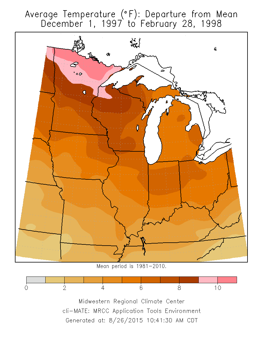
The latest NWS forecast for the winter months of December-February has Illinois with an increased chance of above-average temperatures. In general, the core winter months of December, January, and February, were much warmer in Illinois and the Midwest during the last two major events in 1997-98 and 1982-83.
Along with the warmer temperatures was a noticeable drop in snowfall across most of Illinois during the core winter months. Some places in eastern and southern Illinois saw their snowfall totals cut in half. However, while the overall pattern was for less snowfall, it still snowed. And some places saw significant snowfall events in November and March, outside the core winter months.
Precipitation (rainfall + water content of snow) was closer to average and in some places, such as western and northern Illinois, wetter than average. This suggests that many of the snowfall events were replaced by rain events under the much warmer conditions.
1997-98 El Niño
The 1997-98 El Niño event saw much above average winter temperatures across Illinois and the Midwest. For Illinois, it was the 3rd warmest December-February on record at 34.6 degrees, and 5.6 degrees above average.
Continue reading “Last Two Big El Nino Events – Milder Winters in Illinois”