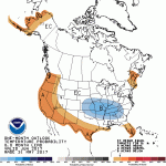
The NWS released their outlooks for the month of July and the 3-month period of July-September.
Illinois and much of the US has an increased chance of warmer-than-normal temperatures for both July and July-September (first column in the figure). Illinois has equal chances of being above, below, and near-normal on rainfall – a virtual coin toss. That is not a surprise on the rainfall. Most of our summertime rain is guided by local conditions and fast-changing weather patterns.

Historical Trends for July
Temperatures: Historically in Illinois, daytime temperatures in July have become milder over time (first graph) while nighttime temperatures have become warmer over time (second graph). While the decreased heating during the day may be welcome, the increased warming at night can be problematic for humans, animals, and plants as they rest. The green line is a smoothed curve to help the eye see the underlying pattern of change from the variability of individual years. Continue reading “Outlook for Summer, Above Normal Temps”
Dryness Continues in Central Corn Belt
Summary: Rapid drying has occurred across the central Corn Belt since June 1 as virtually no rain has fallen, including most of central and northern Illinois. In addition, high water demand on soils has caused soil moisture to steadily drop in sites across Illinois. Estimates at one location in central Illinois put the water loss from evaporation in the soils and transpiration from plants at 2.4 inches since June 1.
When we get this short-term combination of little rain, high temperatures, and high evapotranspiration rates in summer months, we call it a “flash drought” because conditions can deteriorate rapidly such as they did in the 2012 drought. In my opinion, we are not quite there yet, but we could be if this continues for another few weeks.
Current Conditions and Forecast
Rainfall: Here is the map showing the dryness across the central Corn Belt since June 1. The area shaded gray has had almost no rain at all. Areas in orange have received 0.1 inches or less.
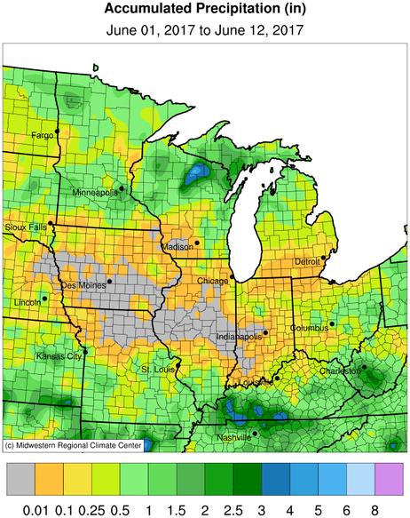
Continue reading “Dryness Continues in Central Corn Belt”
June Looking Dry in Illinois
Here is the rain so far in June. Dryness stretches across the Corn Belt with the only significant rains falling in KS, KY, and southern MO and IL. The stretch from SD through central IL (shaded gray) showed no rainfall at all. At the same time, we have had sunny skies and low humidity – a good recipe for evaporating water out of the ground and transpiring it out of vegetation. Current estimates are that we are losing about 0.2 inches of moisture per day. That is not serious yet because of the wet May. However, if this pattern continues we could start to see trouble ahead.

Speaking of the pattern continuing, here is the 5-day forecast of precipitation amounts. Notice the lack of precipitation across most of IL as well as the rest of the southern half of the Midwest. Even the areas shaded in green show only modest amount of rain (0.01 to 0.25 inches). The NOAA 6-10 and 8-14 day forecast show a return to wetter conditions. However, I have lower confidence in precipitation forecasts beyond 5 days. Furthermore, the models indicate a return to much warmer conditions, starting this weekend.

Cool, Wet May for Illinois
Based on preliminary numbers, the statewide average temperature for May was 61.9 degrees, 0.8 degrees below normal. A few stations in Illinois had highs reaching 90 degrees, including Moline and Springfield. In mid-May, several stations dropped below freezing including Mt. Carroll with 29 degrees.
The statewide average precipitation for May was 5.22 inches, 0.62 inches above normal. The precipitation was heaviest in the central third of the state (map) with a few drier areas around Bloomington and south of the Quad Cities. Areas in red received 5 to 8 inches of rain. Areas in shades of beige received between 2 and 5 inches of rain. Danville reported the most rain for the month in Illinois with 10.19 inches. The nearby station of Henning came in second in the state with 9.98 inches.
Widespread heavy rains were common in southern Missouri, Indiana, Ohio, and Kentucky as well.
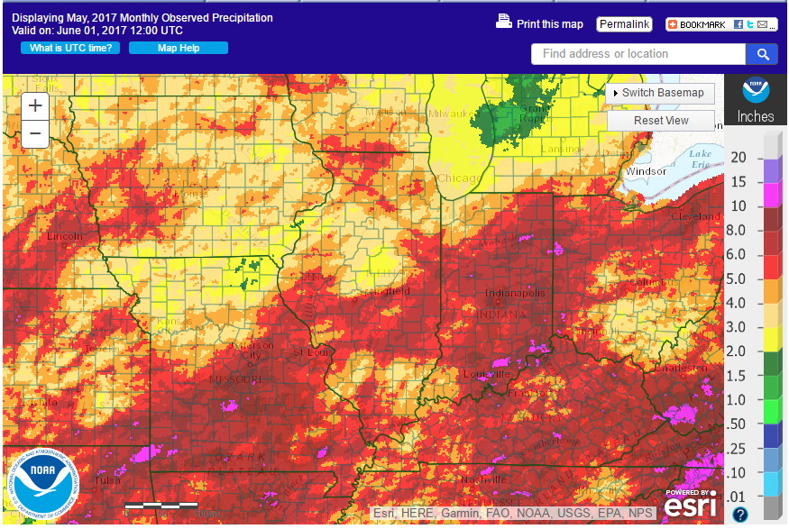
Here is the same map, only showing the departures from normal rainfall. Areas in green and blue are above normal. Areas in blue are 2 to 4 inches above normal. Areas in yellow are 1 to 2 inches below normal. 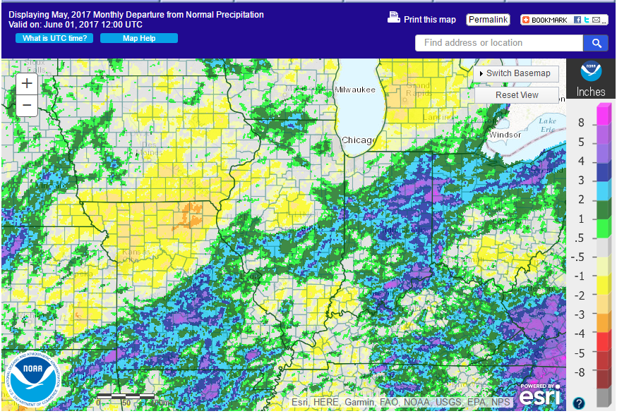
Can we expect more of the same for June? Yes, the latest June outlook from the NWS shows that the southern two-thirds of Illinois has an increased chance of being cooler than normal (left panel) and the southern half of Illinois has an increased chance of being wetter than normal (right panel).