Wettest July-August, Second Wettest August in Illinois

Illinois is already experiencing its wettest July-August and second wettest August on record with a few days left in August. [updated through August 30]

August

Based on rainfall through August 30, the statewide average rainfall for August is 6.70 inches, 3.11 inches above normal and the 2nd wettest August on record. The wettest August was 1977 with 6.86 inches. Continue reading “Wettest July-August, Second Wettest August in Illinois”

Wet August in Illinois

As of yesterday, the statewide average rainfall was 4.47 inches. That is already 0.9 inches above normal for the month and the 27th wettest August on record (since 1895). The wettest August on record was 1977 with 6.86 inches. The latest NWS forecast is showing the potential for another inch of rain to fall in the next 7 days (last map). That would put us in the top ten wettest Augusts on record.
The highest rainfall total in the state for August is Waltonville (Jefferson County, in southern Illinois) with 13.43 inches. A CoCoRaHS station just 3 miles away reported 12.94 inches (IL-JF-2).
Here are the rainfall totals through the morning of August 19 (left) and the departure from normal (right). The heaviest amounts have been in southern Illinois with 6 to 10 inches pretty common. Most of the state is well above normal on rainfall except for a spot in western Illinois and several counties in northeast Illinois. Click to enlarge.


Continue reading “Wet August in Illinois”

Fall and Winter Forecast for Illinois

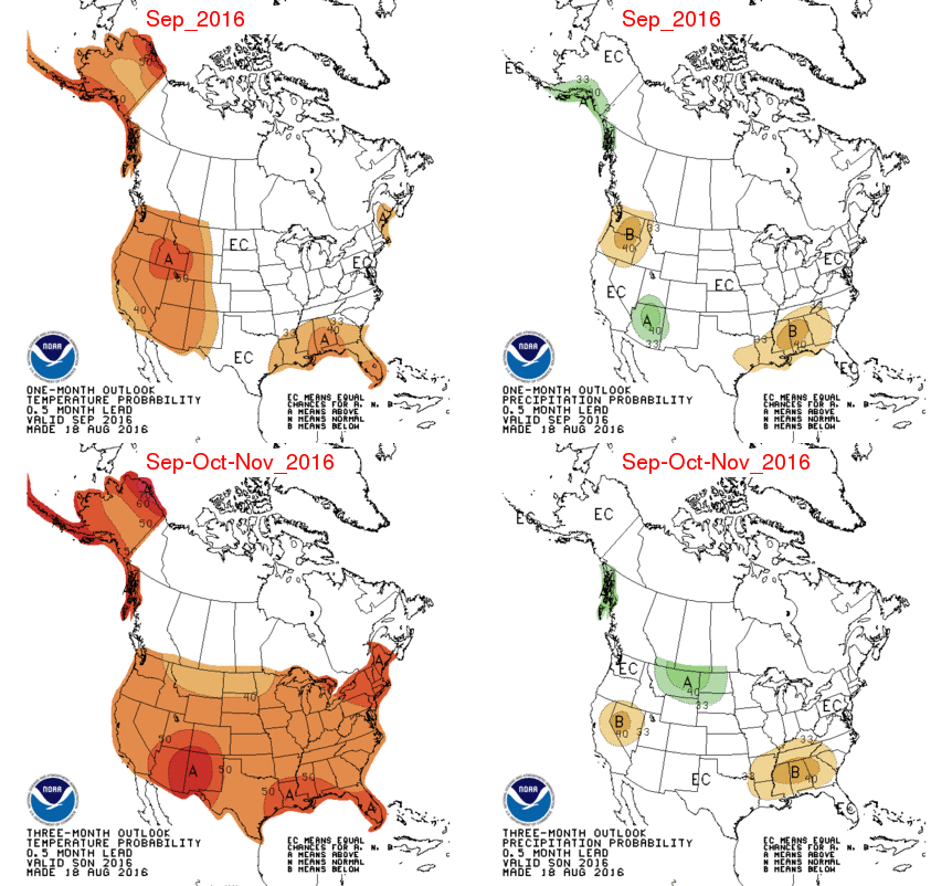
Summary: The NWS Climate Prediction Center has issued their forecasts for September, September-November (Fall), and December-February (Winter). Illinois has an increased chance of being warmer than normal this fall, and wetter than normal this winter.
According to the Climate Prediction Center, the main factors in the forecast are the recent warming trends and the expected La Niña. While the conditions in the Pacific are in the neutral stage between El Niño and La Niña, there is a 55-60 percent chance of a weak La Niña during fall and winter.

Fall

The September forecast (top row) has Illinois and the Midwest with equal chances of being above, below, and near-normal on both temperature and precipitation. I call this a neutral forecast since there are no indications that we will be significantly cooler, warmer, wetter, or drier.
The September-November forecast (bottom row) has Illinois and the US with an increased chance of being warmer than normal. They are neutral on the precipitation forecast.
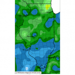
page2

Winter

Continue reading “Fall and Winter Forecast for Illinois”

5-Day Rainfall in Illinois and Midwest

Here are the 5-day accumulated rainfall totals for Illinois and the Midwest. Rainfall was heaviest south of Interstate 70 where amounts of 4 to 8 inches were common (lighter shades of blue). The largest 5-day rainfall total was from a CoCoRaHS station at Waltonville (IL-JF-2) with 10.79 inches. CoCoRaHS is a national network of trained volunteer precipitation observers, learn more at cocorahs.org
Continue reading “5-Day Rainfall in Illinois and Midwest”