Today I had a reporter ask if the recent rains and flooding in Illinois will benefit the low lake levels of Lake Michigan. It has helped.
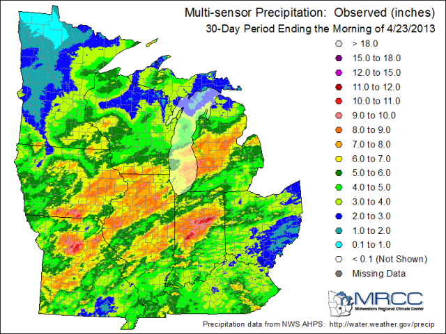
First of all, the Illinois part of the Lake Michigan basin is relatively small and extends only a few miles inland (see first figure below). As a result, most of the rain that fell in Illinois in recent weeks ended up going down the Illinois River instead. However, as the 30-day multi-sensor precipitation map (second figure) for the Midwest shows, the heavy rains continued over the southern third of Lake Michigan as well as into the Michigan side of the Lake Michigan basin. Amounts in the those areas were as high as 6 to 9 inches in the last 30 days which is well above average.
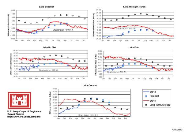
As a result, we have seen water levels rise on Lake Michigan in April. The third figure below is from the US Army Corps of Engineers Detroit Office showing the status of all five lakes lat week. In the upper right hand corner is the plot for Lake Michigan-Huron. The blue line is this year, and the red line is last year. The blue dots are the forecast and the grey dots are the long-term average. You can see that the Lake Michigan lake level has risen by five inches since the beginning of April. You may want to click on the image to get the larger view or look at the original report, in a higher resolution pdf file, here.
The current forecast for Lake Michigan by the US Army Corps of Engineers, released in early April, suggests that water levels will remain below-average for the next six months and will likely be just a few inches above the record levels.


