There is a 95% chance that El Niño will continue through winter and gradually weaken through spring 2016, according to the NOAA Climate Prediction Center today. That remains essentially unchanged from last month’s outlook. As noted in a earlier post, this increases the chances of a mild winter in Illinois.
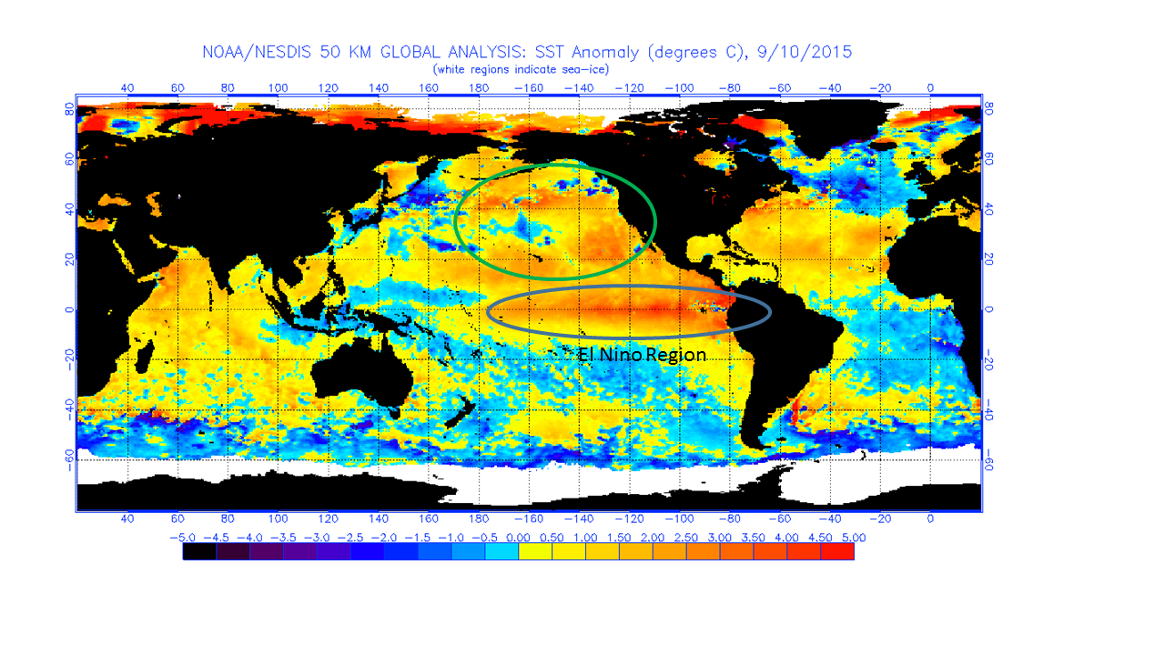
Here are the recent sea surface temperatures, as a departure from the average, in the Pacific Ocean basin. The units are in degrees Celsius, so just double the number to get the approximate departure in degrees Fahrenheit. This represents an impressive amount of heat, considering that these warmer water temperatures cover thousands of square miles.
The traditional area for El Niño formation is circled and labeled on the map. The one wild card in the current situation is that we have exceptionally warm waters farther to the north than what I have seen in past El Niño episodes (green circle). This could potentially change the impacts of El Niño over North America.