Monthly Temperature and Precipitation for 2015 in Illinois

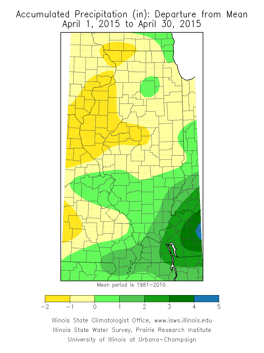
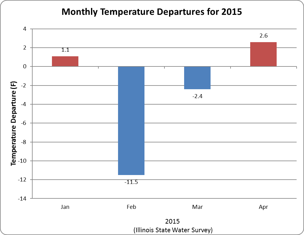
How things are shaping up in 2015? The outstanding features so far are the extremely cold February and the extremely wet conditions in southern Illinois while dry elsewhere.

Monthly Temperature Departures from Average

Blue means colder than average, red means warmer than average. Temperature departures from average tend to cover very large areas, making the statewide average temperature departure a good indicator of conditions around Illinois.

image027

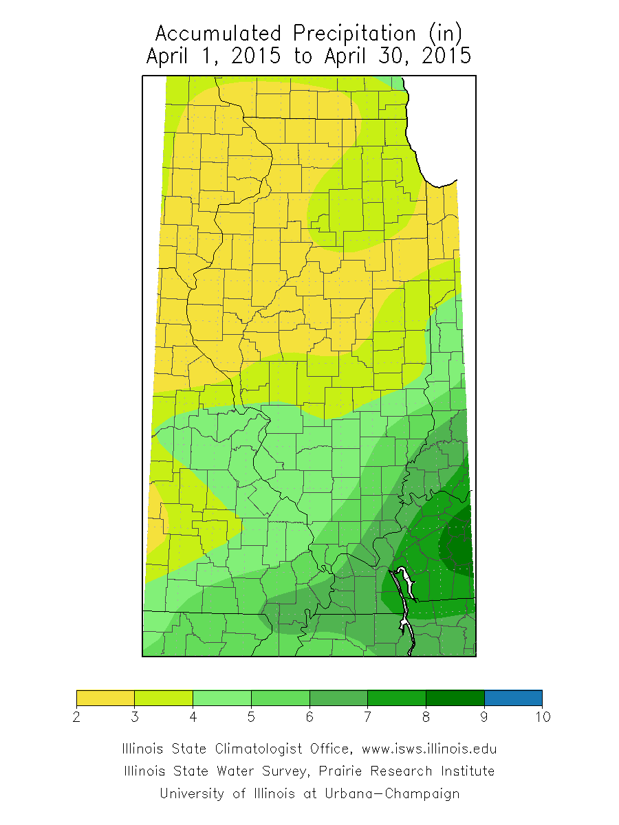
Monthly Precipitation Departures from Average

Continue reading “Monthly Temperature and Precipitation for 2015 in Illinois”

Above-Average Temperatures for April in Illinois

While there were a few cold stretches in April, the statewide average temperature for the month was 54.1 degrees, 1.7 degrees above average.

Precipitation in Illinois for April was more complicated. April precipitation was in the range of two to four inches in northern and central Illinois, and 4 to 7 inches in southern Illinois. As a result, the northern two-thirds of the state was slightly below average while the southern third was up to 2 inches above average. Fort Massac State Park reported the highest monthly precipitation total of 7.80 inches.

prcpmo1
April Precipitation. Click to enlarge.
prcpmo2
April Precipitation Departure. Click to enlarge.

Continue reading “Above-Average Temperatures for April in Illinois”

Seasonal Outlooks for Illinois

Last week, the Climate Prediction Center released their outlooks for February and beyond. There is nothing exciting to report for Illinois. Both the outlook for February and the 3-month outlook for February-April have us in “EC” or equal chances of above, below, and near-average temperature and precipitation. See map below (click to enlarge). That’s not bad news – it means there are no increased risks of a colder than average winter.  Continue reading “Seasonal Outlooks for Illinois”