The heavy rainfall across the Midwest in recent weeks has increased the risk of flooding on the Illinois and Mississippi Rivers. Rainfall totals were highest in western Illinois, northern Missouri, much of Iowa, southeastern Minnesota, and western Wisconsin, and ranged from 6 to 12 inches in the last 30 days. See the MRCC map below.
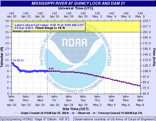
The National Weather Service produces forecasts of river levels based on current conditions and precipitation over the next 24 hours. At Quincy Lock and Dam, the Mighty Mississippi River is expected to be in “major” flood by sometime Thursday (first graph). See the latest forecast for this site here.
It is a similar story on the lower Illinois River. The current and forecasted river stage at Hardin, IL (second graph) shows that the river will reach “major” flood stage by next Monday. See the latest forecast for this site here. Of course, more rainfall in coming days will change these forecasts.