Warmest, Second Wettest December in IL

flood1
Flooded park in Champaign, IL.

Looking at the preliminary numbers, Illinois has experienced its warmest, and second wettest December on record. Statewide records go back to 1895.

Precipitation: the statewide average precipitation was 6.70 inches, 4.01 inches above average and the second wettest December on record.

The wettest December on record was in 1982 with 7.17 inches. Like this year, that was also during a major El Niño event.

Temperature: the statewide average temperature for December is 40.6 degrees, an incredible 10.7 degrees above average and the warmest December on record. This December beat the old record by 1.7 degrees that was set in 1923 with 38.9 degrees.

[this posted was updated on January 2, 2016, to reflect the latest information for December 2015]

Warmer-than-average December in Illinois

The NWS released their latest forecast for December and it is calling for very strong odds of a warmer-than-average December for Illinois and a large portion of the United States. They put the chances at 70 percent or higher in northern Illinois and the Great Lakes region. The odds are between 60 and 70 percent for the rest of Illinois. Those are about the strongest odds that I have ever seen in a monthly forecast.

This forecast for December is strongly supported by the various forecasts out to 14 days, which are also calling for very strong chances of above-average temperatures.


off15_temp

The precipitation forecast is not as striking – increased odds of wetter-than-average conditions in the south and along the East Coast. That’s a classic El Niño precipitation pattern in winter months for those regions.

off15_prcp

Mild Winter Weather Not Expected to Last in Illinois

The mild winter weather is not expected to last in Illinois, but you probably already knew that.

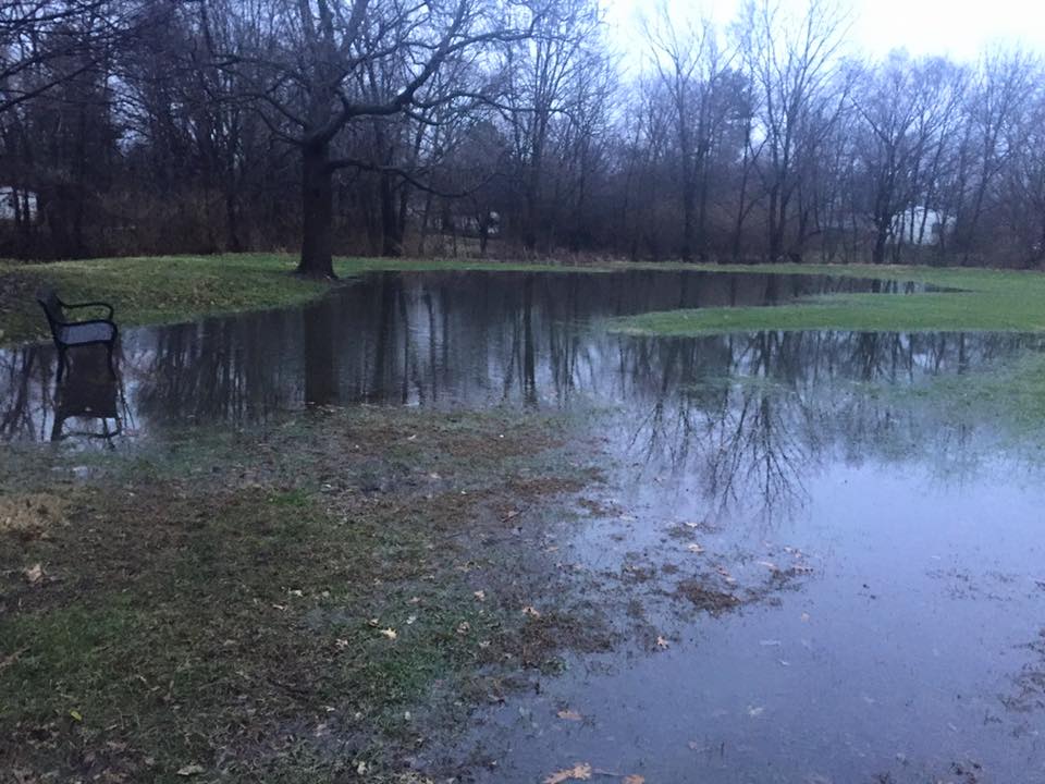
How mild has December been? As of December 18, the statewide average temperature for December stands at 34.3 degrees, 2.1 degrees above average. Precipitation (both rain and the water content of snow) stands at 1.13 inches. Areas north of I-70 are much drier with amounts closer to half an inch, while south of I-70 amounts of 1-4 inches are common. At this point there has been very little snow in December, although that is about to change soon.

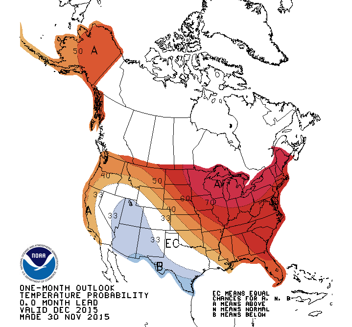
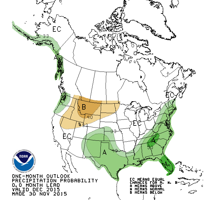
The latest NWS outlooks for January and the rest of winter are shown below (click to enlarge).

The temperature forecast for both January and the January-March period show almost all of Illinois with a higher chance of below-average temperatures. Only far northern Illinois escapes this forecast. On the other hand, precipitation has a higher chance of being below average across Illinois and the Great Lakes region. In most cases, these long-range forecasts only nudge the temperature by a few degrees. So, there is still little sign that this winter will be as severe as last.

The NWS does not issue a winter snowfall forecast. And, a combination of colder temperatures and less precipitation does not always translate into less snow. Many times colder weather produces lighter fluffy snow that accumulates but has less water content. We saw a lot of that last winter.  However, even if this forecast of colder and drier conditions captures the overall pattern of this winter, we could still see some significant winter storms. Be prepared.

page2

map_btd

December in Illinois – Warm with Little Snow

Temperature

The statewide average temperature for December 2011 in Illinois was 35.7 °F, 5.9 °F above average. This ranked as the ninth warmest December on record with statewide records going back to 1895. The highest temperature for the month was 67 °F at Cairo on December 5. The lowest temperature was 0 °F at Monmouth on December 10.

Precipitation

The statewide average precipitation for December in Illinois was 3.43 inches, 0.74 inches above average or 127 percent of average. The highest precipitation total for the month was Brookport Dam (along the Ohio River) with 7.70 inches.

Snowfall

Snowfall totals for December were much below average across the state. The highest snowfall total for the month was at Stockton (far northwestern corner of Illinois) with 4.0 inches. This stands in stark contrast with December 2010 when the highest snowfall total was at Galena with 30.0 inches.

Maps

Precipitation totals for December 2011 in Illinois. Click to enlarge.

Precipitation departures from average for December 2011 in Illinois. Click to enlarge.

Snowfall totals for December 2011 in Illinois. Click to enlarge.

Snowfall departures from average for December 2011 in Illinois. Click to enlarge.