For Illinois, the preliminary statewide average temperature was 64.1 degrees, 1.3 degrees above normal. Basically the first 17 days of the month ran on the cool side (1.4 degrees below normal) while the rest of the month ran on the warm side (4.8 degrees above normal). The map below shows the temperature departures.
The statewide average rainfall was 5.68 inches, 1.42 inches above normal or 133% of normal. The heaviest amounts for the month were in western Illinois between Quincy and the Quad Cities. Dallas City, along the Mississippi River, reported 9.07 inches for the month.


Warmer Conditions Prevail in Late May
After a cold start to May (see earlier post), the period between May 18 and 27 was much warmer. The statewide average temperature during this period was 3.7 degrees above normal. The earlier cold period and this later warm period will pretty much cancel out, leaving May temperatures close to normal as we near the end of the month.
The statewide rainfall for the month is at 5.48 inches, 1.71 inches above normal. While wetter than normal, this is a long ways from the record May rainfall for Illinois of 8.87 inches set in 1943.
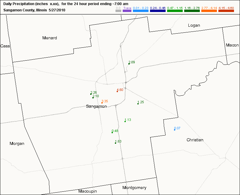
On a personal note, I drove through Springfield on I-72 on the afternoon of May 26 when a severe thunderstorm developed over the city. According to CoCoRaHS weather observers in Springfield, rainfall reports ranged from 2.10 on the far west side to 4.60 inches in the east-central side of the city – all in less than 2 hours (see map). I drove through wind-driven rain, lightning, and pea-sized hail. The flooding along the I-72 and I-55 entrance and exit ramps was impressive but conditions were even worse in town.

Monitoring US and Global Climate Conditions
NOAA has an excellent website for monitoring global and U.S. conditions at http://www.ncdc.noaa.gov/climate-monitoring/index.php This site gives an overview of temperatures, precipitation, global hazards, tornadoes, wildfires, droughts, and other conditions for each month. The monthly reports are typically posted about a week or so after the end of the month. You can choose from the archive of past months/years as well.
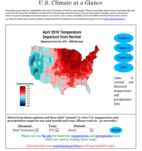
Here is a screen shot of one of the many products available. This one is called the “U.S. Climate at a Glance” product. With this particular product you can generate national, regional, statewide maps as well as plots for key cities. Give it a try.

Impact of Wet Fields on Corn
Emerson Nafziger, University of Illinois agronomist, posted an interesting article about the impact of wet fields on newly planted corn. The article appears in the current issue of The Bulletin, published by the College of Agricultural, Consumer, and Environmental Sciences (ACES). The article starts out about frost damage but halfway down Emerson addresses the potential damage of all the heavy rains.
A larger concern after heavy rainfall in parts of Illinois this week will be standing water and, for the crop recently planted, the possibility of emergence problems. There were a few reports of death of germinating seeds in fields planted a few days before heavy rain in parts of western and southwestern Illinois, but this is not widespread. We think that such seeds simply ran out of oxygen and that shoots died before emergence. Seedlings that have emerged and have roots are more resilient, but there is a very good chance that plants that stand in water for more than two or three days will not survive, especially if temperatures go up. Higher temperatures mean less oxygen in the water and also faster seedling metabolism rates, so plants run out of oxygen sooner.
Even if plants survive, their regrowth can be slow due to poor conditions around the roots. Diseases can also invade plants that stand in water; one example is the downy mildew fungus that can carry crazy-top, whose symptoms won’t appear for weeks after the water is gone. In any case, we often see plant size and health diminish as we move from the edge to the middle of low areas where water stood. If the size of the drowned-out area is large enough to justify a repair-planting after it dries up, it might be a good idea to plant into the area around the edge with living but slow-growing plants as well, in order to replace sickly plants with healthy ones.
In an earlier post, I noted that areas in western and northern Illinois were exceptionally wet in the first half of May. The latest NASS report for Illinois shows that as of May 16, 56 percent of the state had topsoil moisture rated as surplus.

