
In contrast to November, December 2018 finished warmer than the long term average, was lacking in major winter storms, and brought a historic late season severe weather outbreak.
- The statewide average temperature for December was 34°F, which is 4.1°F above the long term average.
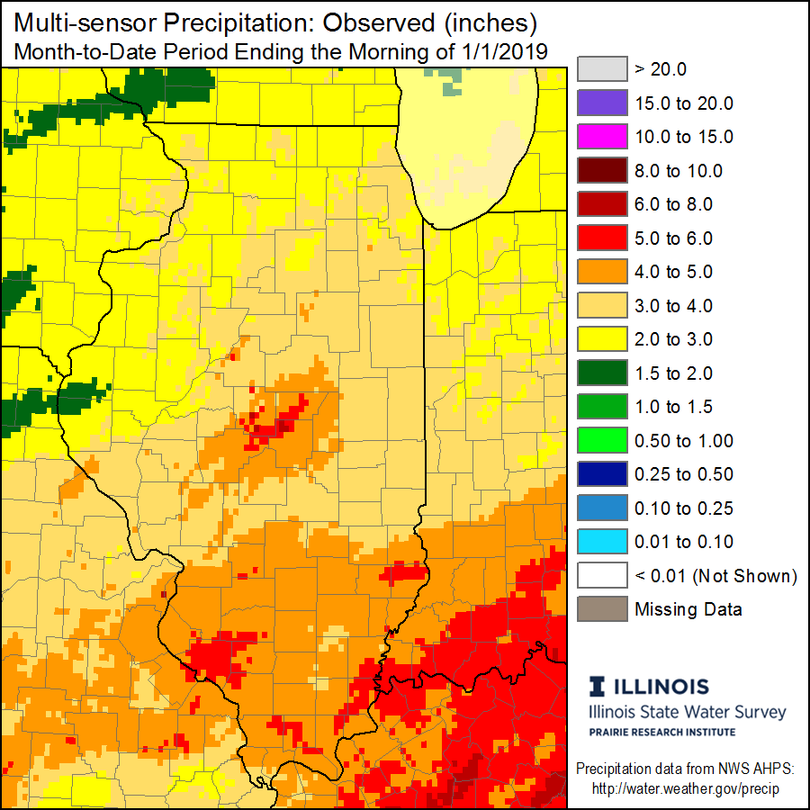
- The statewide average precipitation for December was 3.35 inches, which is 0.66 inches above the long term average.
- The highest temperature recorded for the month was 71°F on December 2nd at the Kaskaskia River Lock and Dam in Randolph County.
- The lowest temperature recorded for the month was 6°F on December 28th at both the Altona and Mount Carroll stations in Knox and Carroll Counties.
- The highest monthly rainfall total of 6.83 inches occurred at a station near Chester, which is located in Randolph County.
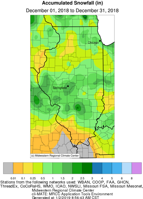
- The highest monthly snowfall total was only 3.1 inches, and was recorded at a station near Patoka in Marion County.
- The National Weather Service confirmed 29 tornadoes in Illinois during the historic December 1st severe weather outbreak.
Data are provisional and may change slightly over time
Temperatures
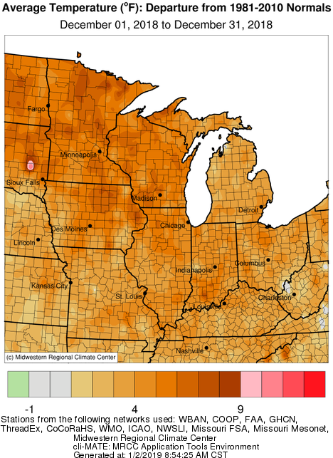
December favored above average temperatures for the entire Midwest, including Illinois The map below shows that the largest temperature departures were felt in the upper Midwest, and extending down into much of northern Illinois where several locations finished the month 6 to 7 degrees above the long term average. Overall, the statewide average temperature for December was 34°F which is 4.1°F above average.
Precipitation
Statewide precipitation totals for December were at or above the long term average. Two storm systems impacting the state during the last week of December helped to bring the monthly totals above normal for much of central and northern Illinois, where precipitation was lacking in the middle of the month. The highest widespread precipitation totals occurred around and south of I-70. The maps below show total December precipitation, as well precipitation departures for Illinois.

December was not an ideal month for snow lovers as warmer temperatures, and a combination of environmental factors kept December snow accumulation to a minimum. The highest accumulations were in the northeast, and in central/west central portions of the state – where a quick moving cold front brought a majority of the snow accumulation during the first week of December. Total snow accumulations are shown in the map below.
Severe Weather
The National Weather Service confirmed 29 tornadoes across Illinois during the December 1st tornado outbreak, ranking this as the largest December outbreak in state history. The previous three largest outbreaks are listed below:
- December 18-19, 1957 with 21 tornadoes
- December 23, 2015 with 6 tornadoes
- December 4, 1973 with 5 tornadoes
Most notable was the Taylorsville Tornado in Christian County. This tornado had a path width over 1/2 mile wide, and estimated wind speeds of 155 mph, ranking it as an EF-3 on the Enhanced Fujita Scale, The Taylorsville tornado caused major damage to 100 homes, and 22 reported injuries.
The map below, from the Storm Prediction Center, pinpoints locations of all severe weather reports from 12/1/2018. It is evident that the worst of the severe weather, and tornadoes, were confined to west central Illinois.
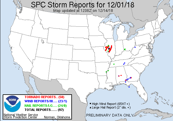
In total, 52 severe weather reports were recorded for Illinois this December; 34 reports for tornadoes, 11 for severe hail, and 7 for severe wind. Note: It is possible for multiple reports to be created for the same event/storm.
Check out the Twitter link from Kevin Lightly, capturing aerial images of damage in Taylorsville the day after the tornado outbreak:
First aerial images of the tornado damage in Taylorville, IL. #cILwx #ILwx @NWSLincolnIL pic.twitter.com/rvgvF2K6PH
— Kevin Lighty (@KevinLighty) December 2, 2018.
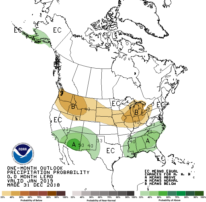
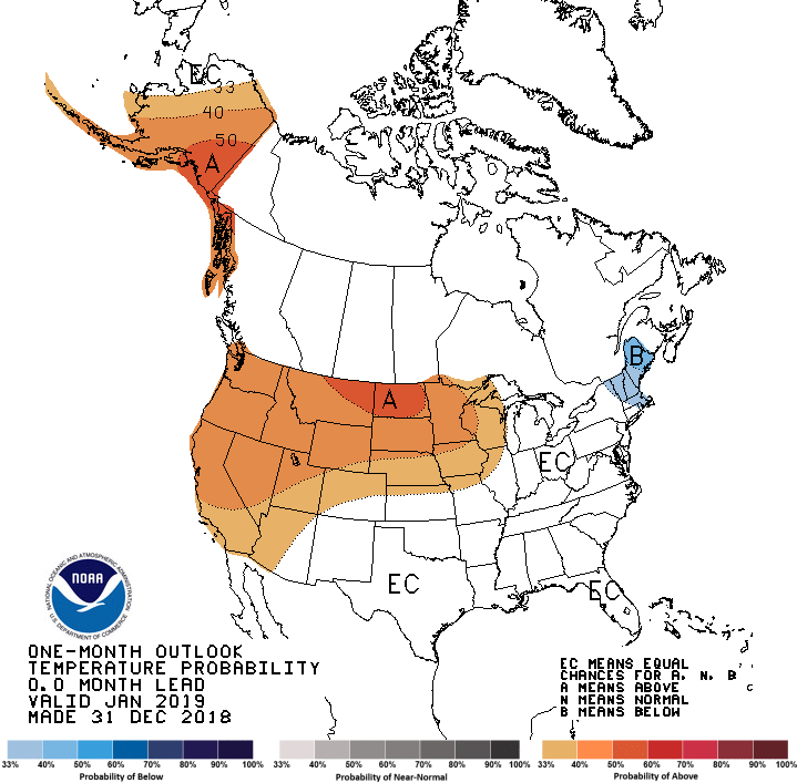
Outlook for January
Looking ahead at the rest of January 2019, the Climate Prediction Center is forecasting an above normal chance for a drier than average January for a majority of the state. The highest probabilities are centered over northern Illinois and the Great Lakes. Focusing on temperatures, the highest probabilities for above average temperatures are concentrated over the upper Midwest and North Dakota, with a smaller probability extending into northwest Illinois.
Be sure to check back in the coming week for the ‘Illinois 2018 Climate and Weather Recap’ blog entry.