Summary: The statewide average temperature for June so far is 75.3 degrees, 4.4 degrees above normal. The statewide average precipitation for June is 3.61 inches, which is about 130% above normal. However, the precipitation is spread unevenly throughout the state. Above-normal temperatures are expected to continue for July.
Temperature: Both the average high and average low for June has been above normal (maps below). The average high ranged from the low 90s around St. Louis to the upper 80s in the southern two-thirds of Illinois. The average high ranged from the upper 70s to the low 80s in the northern third of the state. The average lows ranged from the upper 50s in northeast Illinois to the 60s for the rest of the state.
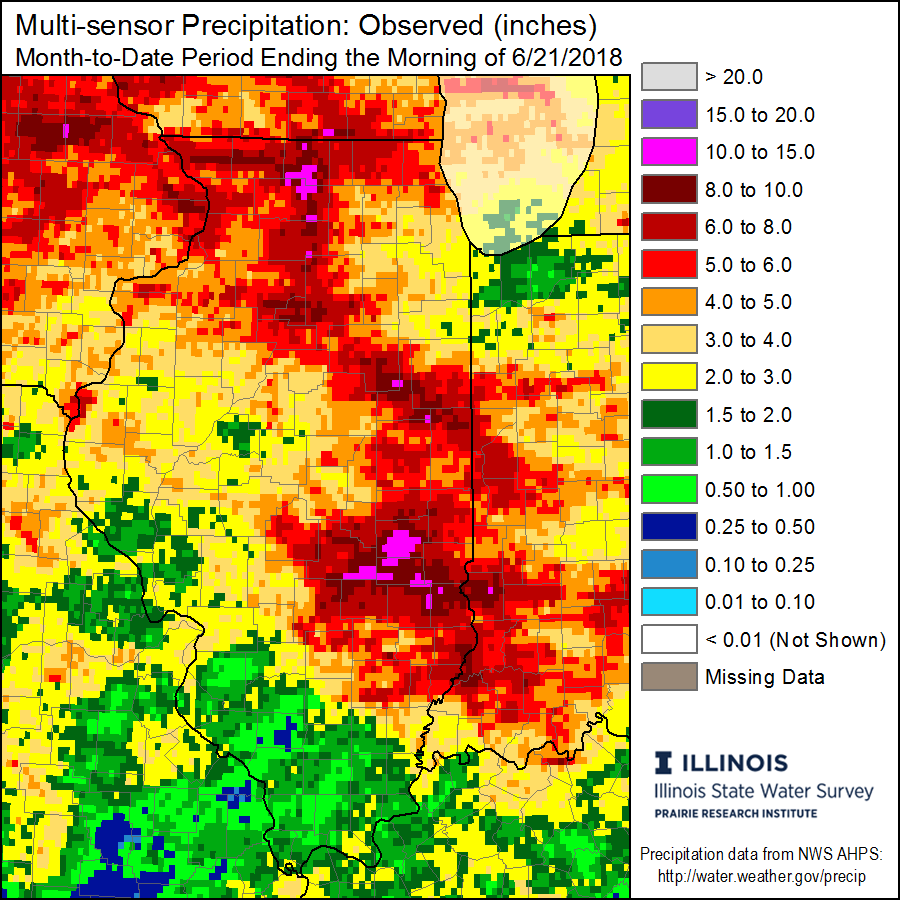
Precipitation: Precipitation was highly variable across Illinois, which is fairly typical for summer months (below). There are a few areas in pink with 10 to 15 inches. Areas in shades of orange and red have precipitation amounts of 4 to 10 inches, well above normal. The largest monthly total so far is Beecher City (Effingham County) with 11.22 inches. Meanwhile, rainfall has been less plentiful in western and southern Illinois with amounts of 2 inches or less.
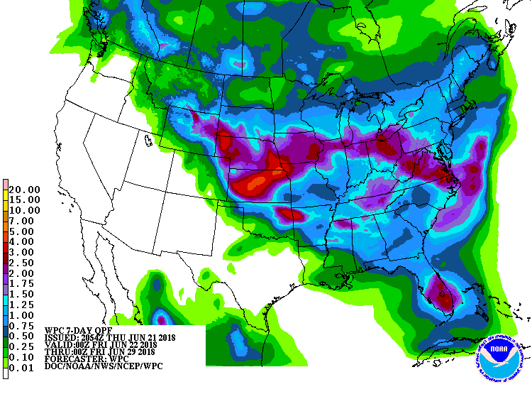
Outlook: More rain is expected across Illinois the next 7 days as a slow-moving low-pressure system moves across the region. The potential amounts range from nearly 3 inches in northern Illinois to about an inch in southern Illinois.
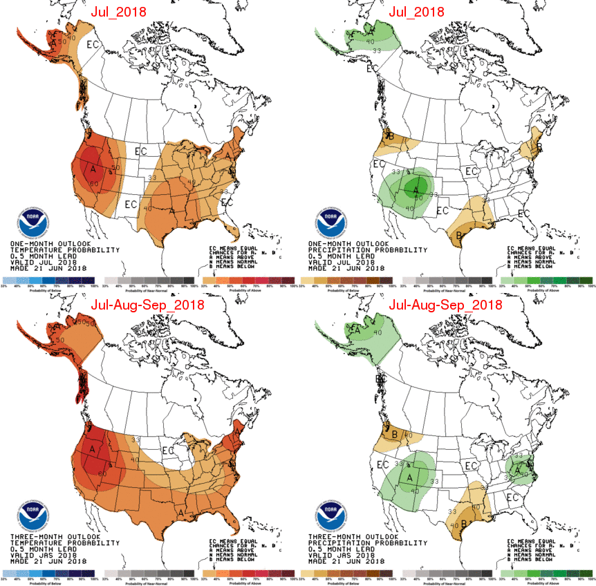
The outlook for July from the NWS says that we can expect an increased risk of above normal temperatures for July (top row of the figure). There is no indication of increased risks of either above or below-normal precipitation for July. For the period of July through September (bottom row), the southern two-thirds of Illinois has an increased chance of warmer than normal conditions. The northern third does not. There are no climate factors to indicate an increased chance of either above or below-normal precipitation during the period of July through September.
