Temperature
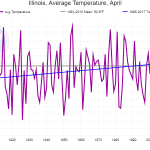
Based on the official data, the statewide average temperature was 44.5 degrees, 8.1 degrees below normal. It was the second coldest April on record, only beaten by 43.1 degrees set in April 1907. Our statewide records go back to 1895. Normal refers to a specific benchmark, the 1981-2010 average. See the longer explanation here.
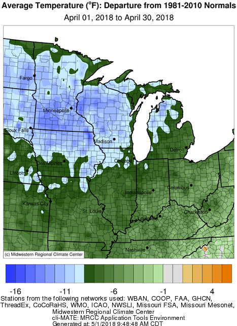
Here are the temperature departures from normal look like across the Midwest. Areas in green are 1 to 9 degrees below normal, while areas in icy blue are 9 or more degrees below normal. The lowest temperature reported in Illinois for April was -1 at both Avon and Lincoln on April 2. At the other extreme, we did reach into the 80s at times during the month. The warmest reading was 86 degrees at Kaskaskia on April 13.
Precipitation
The statewide average precipitation for April in Illinois was 2.37 inches, 1.41 inches below normal. In general, areas in the north and west had lower precipitation totals and were part of a larger area of below-normal precipitation that extended into Missouri, Iowa, Kansas, Nebraska, and beyond. Precipitation is the combination of both rainfall and the water content of snow.
The largest monthly total precipitation was Metropolis, home of Superman, with 6.73 inches as reported by the CoCoRaHS observer (IL-MC-2). On the other extreme, the Quincy Airport reported only 0.63 inches for the month and reflects the other low totals in the area.
Snowfall
Snowfall was widespread across Illinois in April, which is highly unusual. Parts of central Illinois received more snow than northwest Minnesota. Snowfall was above-normal across most of the Midwest. The largest reported monthly total in Illinois was 12.0 inches at Augusta, IL (Hancock County).