
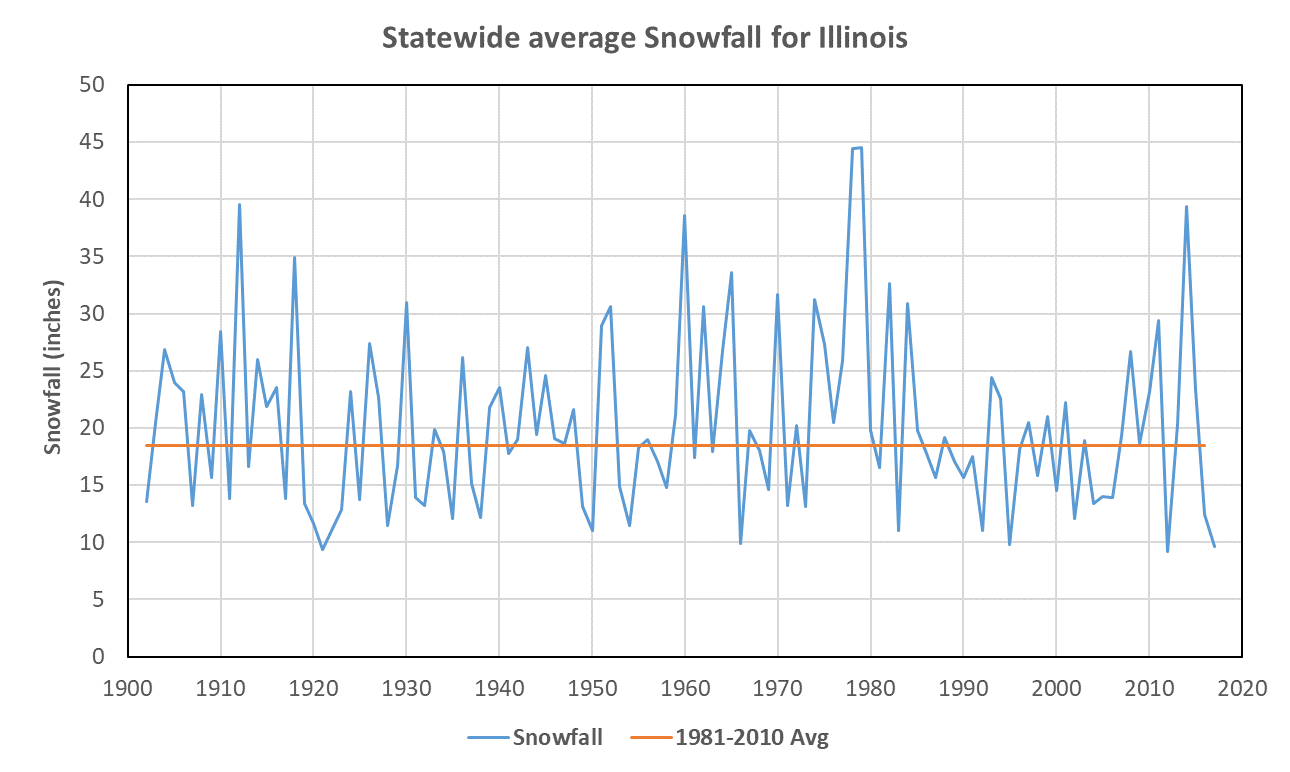
The snowiest winter on record was 1978-79 with a statewide total of 44.5 inches. The winter of 2011-12 had the least amount of snow with a statewide total of 9.2 inches.
While a few stations recorded snowfall in the 1800s, our statewide snowfall records in Illinois began in 1902. There is no long-term trend in the snowfall totals; however, some decades were snowier than others, such as the 1910s, 1960s, and 1970s. In fact, the 1970s were the snowiest decade on record with an average snowfall of 27.2 inches.
Since the 1970s, snowfall amounts dropped steeply with less year to year variability for much of the 1980s and into the early 2000s. However, snowfall amounts in the last six winters have been more variable with the winter of 2013-14 being about as snowy as the late 1970s while the winters of 2011-12 and 2016-17 had the lowest and third lowest snowfall totals, respectively, for the state.
Continue reading “Snowfall Changes Over Time in Illinois”
Snowfall Changes Over Time in Illinois
The snowiest winter on record was 1978-79 with a statewide total of 44.5 inches. The winter of 2011-12 had the least amount of snow with a statewide total of 9.2 inches.
While a few stations recorded snowfall in the 1800s, our statewide snowfall records in Illinois began in 1902. There is no long-term trend in the snowfall totals; however, some decades were snowier than others, such as the 1910s, 1960s, and 1970s. In fact, the 1970s were the snowiest decade on record with an average snowfall of 27.2 inches.
Since the 1970s, snowfall amounts dropped steeply with less year to year variability for much of the 1980s and into the early 2000s. However, snowfall amounts in the last six winters have been more variable with the winter of 2013-14 being about as snowy as the late 1970s while the winters of 2011-12 and 2016-17 had the lowest and third lowest snowfall totals, respectively, for the state.
Continue reading “Snowfall Changes Over Time in Illinois”
Warm 2017 Ends with a Cold, Dry December in Illinois
Temperature
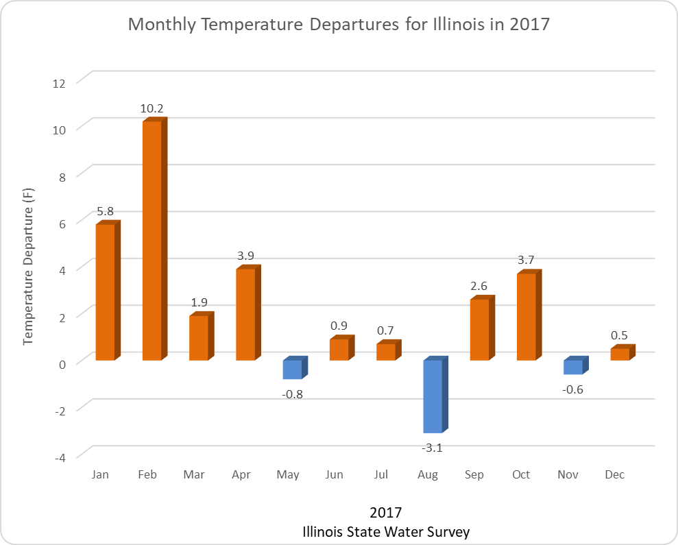
Based on preliminary data, 2017 is on track to be the 6th warmest year on record in Illinois with a statewide average temperature of 54.5 degrees, which is 2.2 degrees above normal. This was in spite the very cold ending to December (more on that in a minute). We experienced the warmest February on record with a statewide average of 41 degrees, 10.1 degrees above normal. On the other hand, Illinois experienced its tenth coolest August on record in 2017 with a temperature of 70.5 degrees, 3.1 degrees below normal. Eight out of the 12 months experienced above-normal temperatures.
December Temperature
Continue reading “Warm 2017 Ends with a Cold, Dry December in Illinois”