
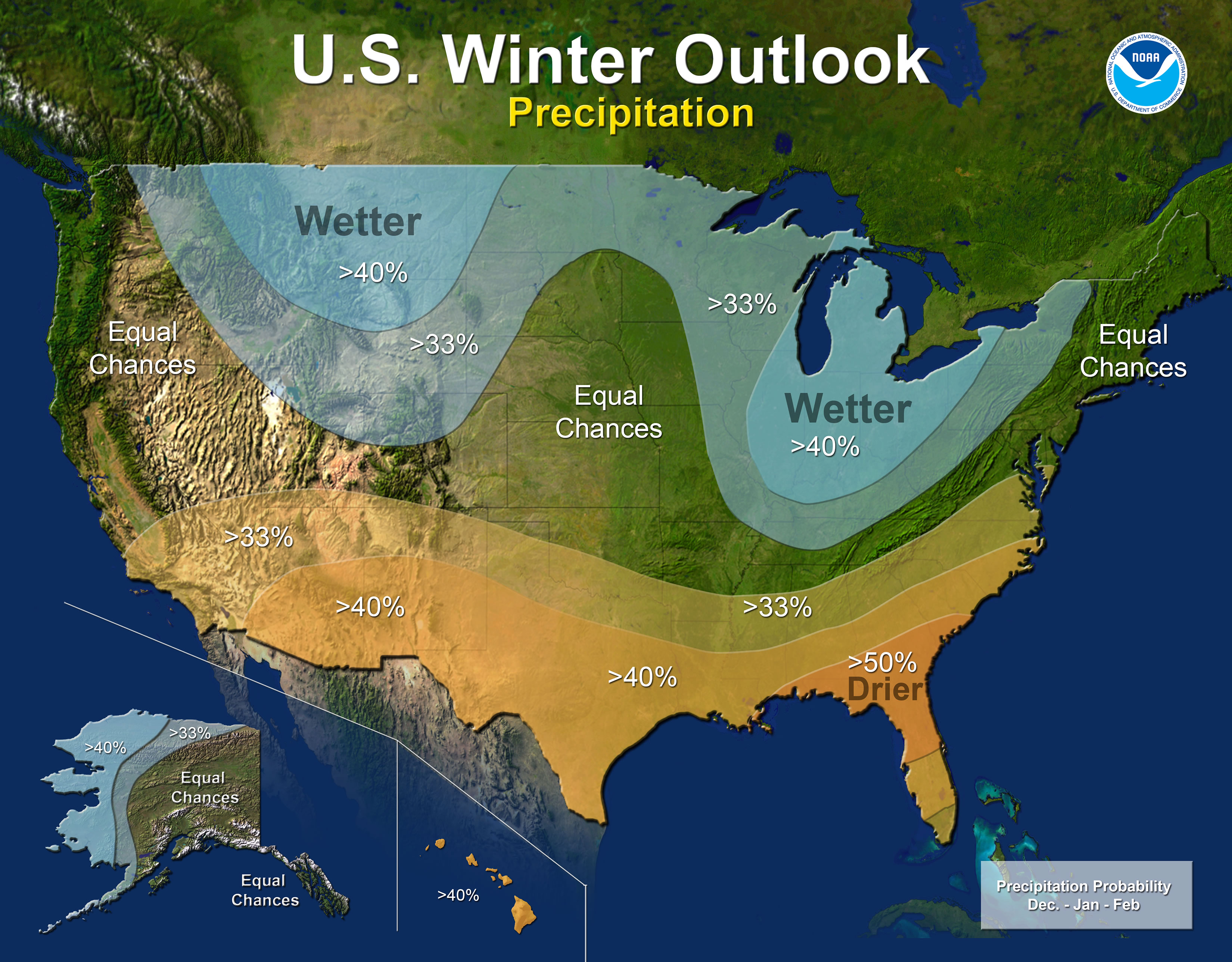
Summary: The NWS rolled out their winter outlook today. There is about a 55 to 65 percent chance of a La Niña developing this fall and winter. However, it is expected to be weak and possibly short-lived. Wetter than normal conditions are favored in Illinois this winter (December-February); however, that may not translate into more snow.
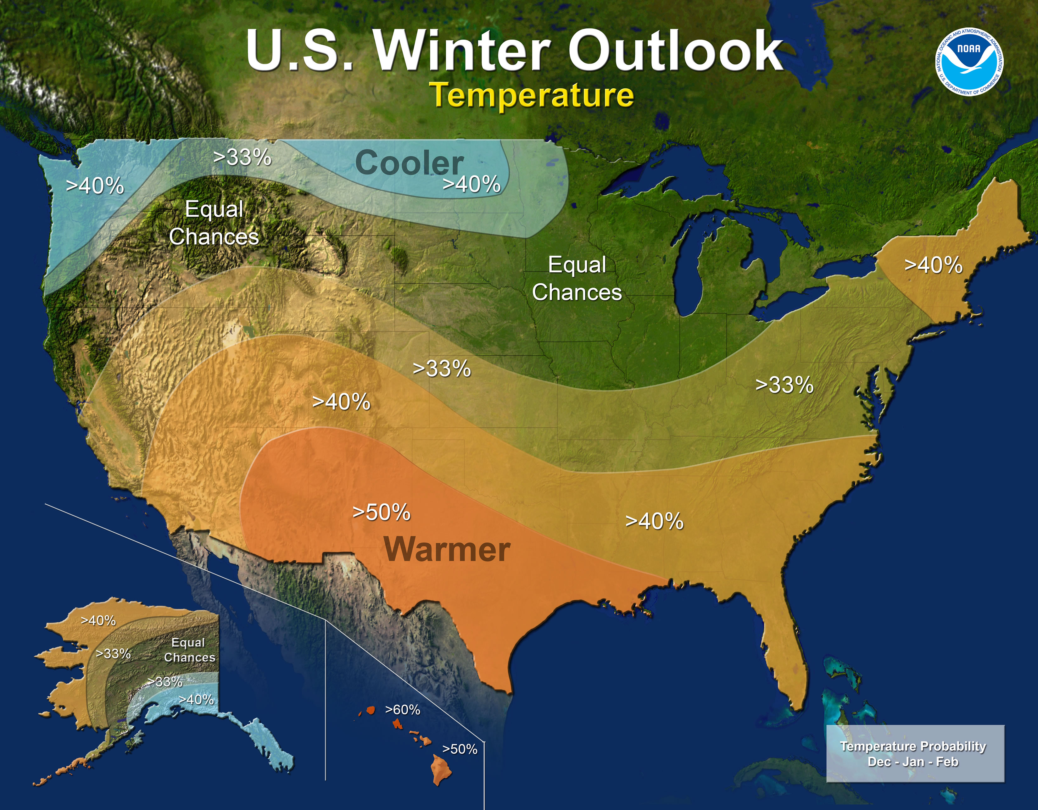
Temperature
For Illinois, only southern Illinois is more likely to have warmer-than-normal temperatures this winter. The rest of Illinois has equal chances of above, below, or near-normal temperatures because there is not a strong climate signal in these areas to suggest warmer or colder conditions.
Precipitation
Meanwhile, wetter-than-normal conditions are favored this winter across all of Illinois. This is part of a wetter pattern associated with La Nina that covers the Great Lakes and Ohio River Valley, as well as the northern Rockies. However, this may not translate into more snow. We can have significant amounts of winter precipitation fall as rain rather than snow, especially in milder winters.
By the way, predicting how much snow Illinois will get in the coming winter is always difficult. One or two big storms can make or break the forecast. Two years ago, our janitor Doug won our office pool on the total amount of snow for the winter in Champaign.
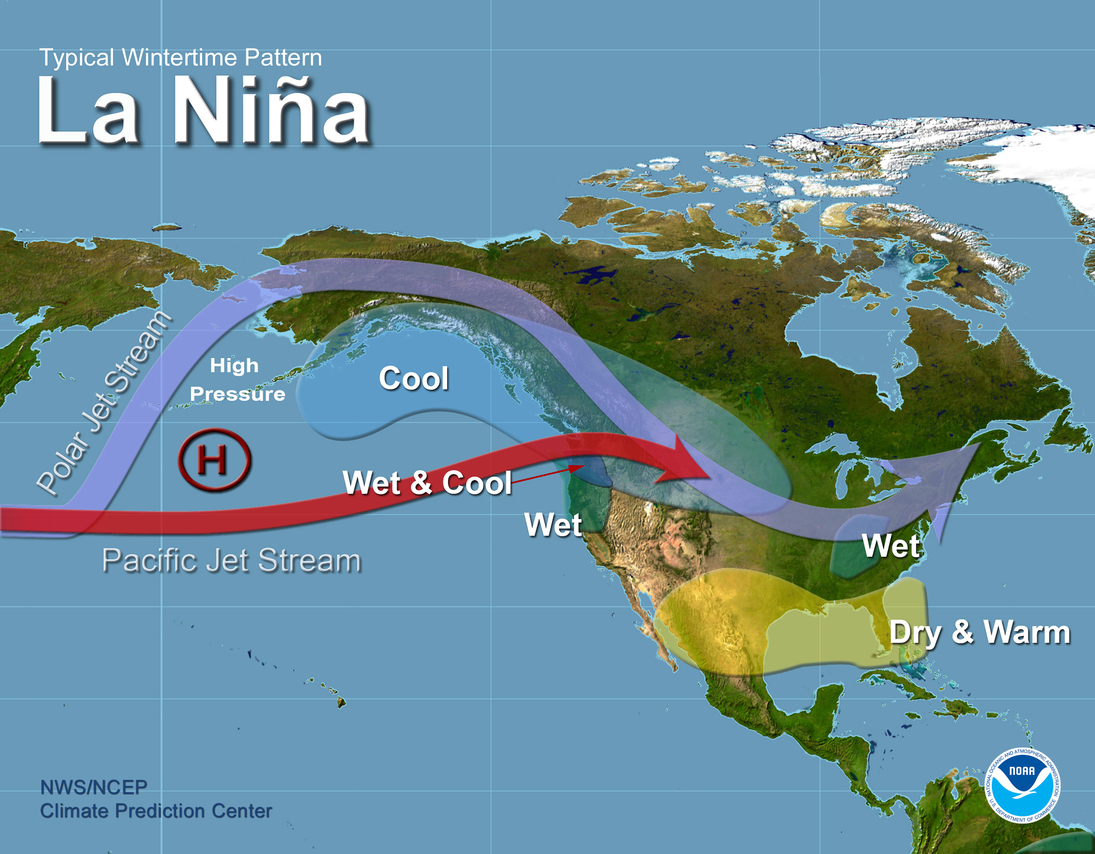
La Niña Pattern
The “typical” winter La Niña pattern is shown below with the jet stream positioned over the Great Lakes more frequently, leading to more storm activity. But there are other factors that can influence our winter weather and many of these occur in a much shorter time frame. For example, the Arctic Oscillation and the dreaded Polar Vortex cannot be reliably predicted more than two weeks in advance.
Last Winter
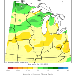
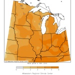
The weak La Niña episode last winter did not produce the expected results in Illinois. Instead of wetter conditions, we had mild temperatures and little snow or rain (maps below, click to enlarge). However, it was wetter in the other Great Lakes states and the Ohio River Valley with above-normal snowfall in the upper Midwest, but the colder temperatures never materialized.
Winter Temperature Trend in Illinois
Finally, here is the plot of winter temperatures averaged across Illinois from 1895 to present. The black line is the 1981-2010 average. We have warmed by 1.7 degrees over the last century, according to the linear trend. Perhaps more meaningful is that only one of the ten coldest winters has occurred since 1980 (2013-14). On the flip side, seven out of the ten warmest winters in Illinois have occurred since 1980 and four out of ten have been since 2000. I’ll show the snowfall plot for Illinois in a future post when I get a chance to update it for the winter of 2016-17.

One Reply to “NWS Outlook for Winter and La Nina”