
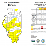
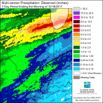
Lots of new information released today. First of all, the latest US Drought Monitor reflects the impacts of the weekend rains in northern Illinois. The rains tapered off in central and southern Illinois so the changes were less dramatic. The areas considered in “moderate drought” have been reduced to isolated pockets. Click on the figures to enlarge. The NWS expects more rain this weekend with amounts in the neighborhood of 1 inch falling in central and southern Illinois.
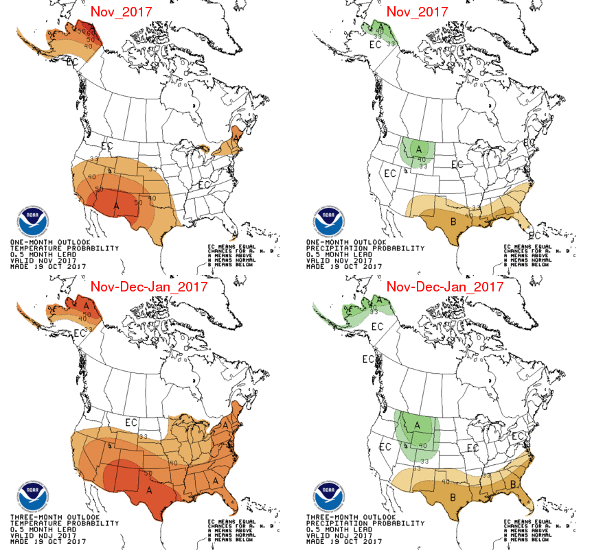
NWS Seasonal Outlooks
The NWS Climate Prediction Center released their latest outlooks for November and beyond. Nothing to report for November in Illinois or the Midwest (first row of maps). They do indicate that Illinois has an increased chance of above-normal temperatures in November- January (second row).
Right now we are in neither a La Niña nor an El Niño situation in the Pacific (referred to as ENSO-neutral conditions). However, La Niña conditions have a 55 to 65 percent chance of appearing sometime in the late fall/early winter, according to the NWS. So far, it is expected to be a fairly mild event and may not have much impact on Illinois.
I will do a separate post later on the NWS outlook for the winter months of December-January-February.