NWS Outlook for Winter and La Nina

Summary: The NWS rolled out their winter outlook today. There is about a 55 to 65 percent chance of a La Niña developing this fall and winter. However, it is expected to be weak and possibly short-lived. Wetter than normal conditions are favored in Illinois this winter (December-February); however, that may not translate into more snow.

Temperature

For Illinois, only southern Illinois is more likely to have warmer-than-normal temperatures this winter. The rest of Illinois has equal chances of above, below, or near-normal temperatures because there is not a strong climate signal in these areas to suggest warmer or colder conditions. Continue reading “NWS Outlook for Winter and La Nina”

New Fall Outlook for Illinois, Reduction in Drought

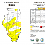
Lots of new information released today. First of all, the latest US Drought Monitor reflects the impacts of the weekend rains in northern Illinois. The rains tapered off in central and southern Illinois so the changes were less dramatic. The areas considered in “moderate drought” have been reduced to isolated pockets. Click on the figures to enlarge. The NWS expects more rain this weekend with amounts in the neighborhood of 1 inch falling in central and southern Illinois.

NWS Seasonal Outlooks

The NWS Climate Prediction Center released their latest outlooks for November and beyond. Nothing to report for November in Illinois or the Midwest (first row of maps). They do indicate that Illinois has an increased chance of above-normal temperatures in November- January (second row). Continue reading “New Fall Outlook for Illinois, Reduction in Drought”

Heavy Rains Over Weekend in Chicago Area

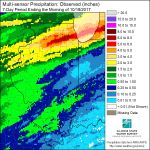
Heavy rains fell across northern Illinois over the weekend. The most impressive rains fell in the Chicago area with record rainfall at Chicago O’Hare on October 14 at 4.19″ and the NWS site near Midway Airport reporting 5.11″. Other sites with large amounts include the NWS COOP site at Glen Ellyn with 11.25″, and the CoCoRaHS sites at Burr Ridge (IL-CK-254) with 9.30″, Downers Grove (IL-DP-127) with 8.35″, and two sites in Lisle with 8.21″ (IL-DP-86) and 8.16″ (IL-DP-30). More rainfall totals are listed below.
The heavy rains resulted in numerous reports of street and road flooding. The eastbound left lane of I-80/90 was flooded at mile marker 3. Law enforcement in Naperville reported, “numerous roads in the city flooded”. Some thunderstorms produced pea size hail as well as caused wind damage (NWS Local Storm Reports listed below). According to the WGN-TV, boat tours on the Chicago River were canceled on Saturday. The Chicago River Walk was closed because you would literally be walking in the river (not the original intent of river walks, by the way). Other cities had similar experiences with parks and river walks.
Continue reading “Heavy Rains Over Weekend in Chicago Area”

Fifth Driest September, Fourth Driest August-September for Illinois

Precipitation

Based on the provisional data, the statewide average rainfall for September was 0.78 inches, 2.45 inches below normal and the 5th driest September on record. The driest September was 1979 with 0.46 inches. Statewide records go back to 1895.
Total monthly rainfall ranged from 4.16 inches at the Rock Island Lock and Dam to only 0.01 inches at Springfield Airport.
It was also the 4th driest August-September for Illinois with a statewide average rainfall of 3.11 inches, which is 3.70 inches below normal.
Continue reading “Fifth Driest September, Fourth Driest August-September for Illinois”