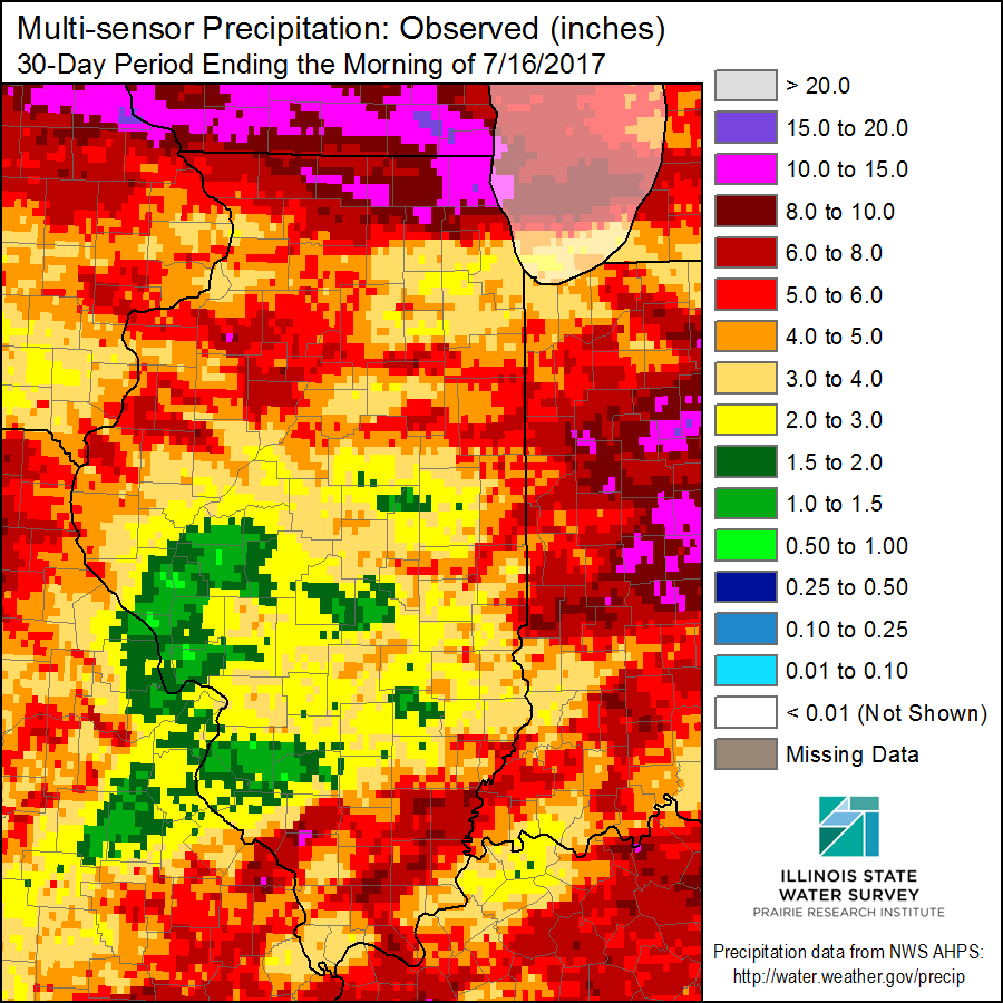
It is fairly typical of summer in Illinois to have areas with too much rain and other areas with not enough. However, the last 30 days have been extremely variable across the state. In the figure below of radar/rain-gage measured precipitation, we see amounts of 10 to 15 inches in Lake County (pink). In many other areas, we see shades of red which represent amounts between 4 and 10 inches. However, interlaced with those wet areas are areas with only 2 to 4 inches. And there are a few areas, especially around St. Louis that have had only 0.5 to 2 inches of rain (shades of green) in the last 30 days.
As you can imagine, areas in northern Illinois are struggling with flood conditions while areas in green are struggling with drought. There are reports of corn “firing” in Jersey and St. Clair Counties according to the Illinois Farm Bureau’s CropWatchers.
The recent NWS 7-day precipitation forecast doesn’t look promising with most of the rain expected to fall in northern Illinois (1 to 4 inches) where it is not needed. Meanwhile, the southern half of Illinois is expected to receive less than half an inch. We will see how this plays out.