

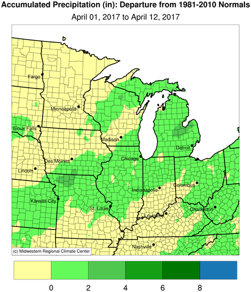
The first part of April has been warmer and wetter than average across much of Illinois and the Midwest. As these maps show, there is a wide band of 1 to 3 inches of rain stretching from Kansas, through Missouri, Indiana, Michigan, and Ohio (click to enlarge) in April. These rains have helped ease concerns of any developing drought after the dry winter. In fact, the concerns have reversed and center around delays in field work from wet conditions.

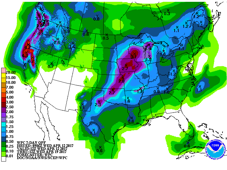
Forecast: The NWS expects more rain across the Midwest in the next 7 days. Expected amounts are heaviest in a band stretching up from Texas, through Wisconsin, including northwest Illinois. The shades of purple and violet (?) represent values between 1.5 and 2.5 inches. The NWS 6-10 and 8-14 days also indicate that Illinois and the Midwest can expect above-average rainfall for the next two weeks.
Temperatures have remained several degrees above average for Illinois and the Midwest for April so far. Currently, the average temperature for April 1-11, 2017, in Illinois stands at 52.7 degrees, 5 degrees above average. NWS forecasts indicate that the warmer-than-normal temperatures will prevail over the next two weeks.
