The preliminary January statistics are in for Illinois. The statewide average temperature was 31.4 degrees, 5.0 degrees above normal and the 14th warmest January on record. The statewide average precipitation was 2.16 inches, 0.09 inches above normal. The statewide snowfall was below normal across the state.
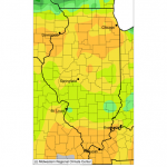
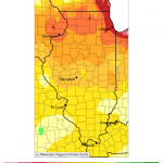
Temperature Maps
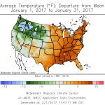
Temperatures have been above normal across the state and across the eastern half of the US for January. Click to enlarge.
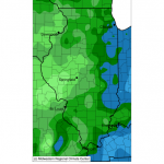
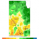
Precipitation Maps
Precipitation represents both rainfall and the water content of snow. On the left is the actual precipitation and on the right is the departure from normal. In general, the eastern and northern parts of the state were wet, while the west and south were drier than normal.
Snowfall Maps
Snowfall was almost non-existent in Illinois in January (left), running less than an inch in many locations, and obviously well below normal (right).
Forecast for February
According to the Climate Prediction Center, we have an increased chance of above-normal temperatures in February. The short-term forecasts out to 14 days seem to bear this out. For the most part, Illinois has equal chances of above, below, or near-normal precipitation. The short-term forecasts out to 14 days suggest wetter than normal conditions. It’s not clear if that will translate into more snow, or just more rain if it is accompanied by mild temperatures.