Spring in Illinois, Warm with Wet and Dry Patches

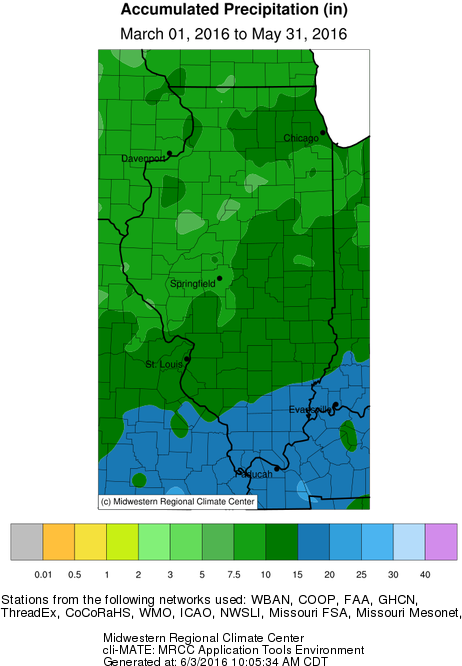
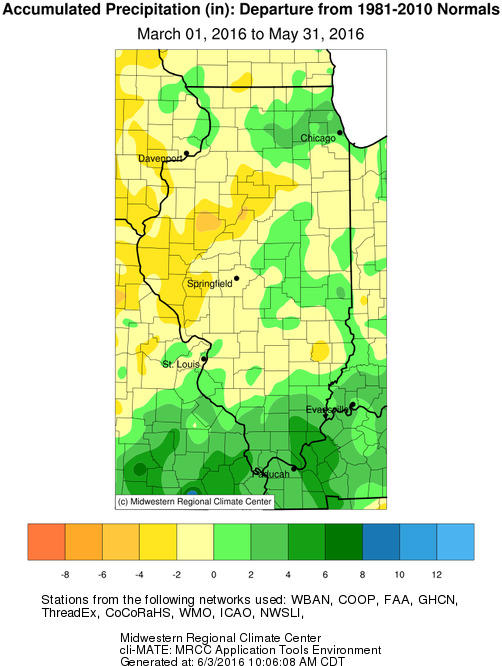
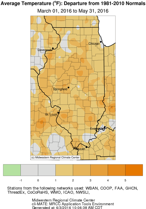
Climatological spring is defined as March, April, and May. Here are how things looked this Spring for precipitation and temperatures. For most of Illinois, precipitation in Spring was close to the 1981-2010 average (normal) with some wet areas in northeast and southern Illinois. Temperatures ended up on the warm side for Spring.

map1
The accumulated precipitation in spring, ranging from 15-20 inches far southern Illinois, to only 5-7.5 inches in small patches near the Illinois River. Most of the state was either 10-15 inches (dark green) or 7.5 to 10 inches (medium green).
map2
The Spring precipitation departures from normal show wet and dry areas of the state. Areas in southern and northeast Illinois were wetter with with amounts 2 to 6 inches above normal (darker shades of green). Areas in western Illinois were 2 to 6 inches below normal. The rest of the state was within 2 inches of normal. 
map3
The temperature departures from normal for Spring show that most of the state was running 1 to 2 degrees warmer than normal. Obviously, there were some stretches of colder than normal weather during Spring but the warmer than normal temperatures prevailed. 

Heavy Rains Strike Parts of Illinois in May

Summary: For Illinois, the statewide average temperature for May was 62.2 degrees, just 0.5 degrees below normal. Underneath the benign numbers were some stretches of cold weather at the beginning and middle of the month before summer-like conditions arrived in the last 10 days of the month.  The statewide average precipitation was 4.52 inches, just 0.08 inches below normal. However, heavy rains struck parts of Illinois, causing flooding. Some areas received up to 9-10 inches of precipitation by the end of the month.

Precipitation

Continue reading “Heavy Rains Strike Parts of Illinois in May”