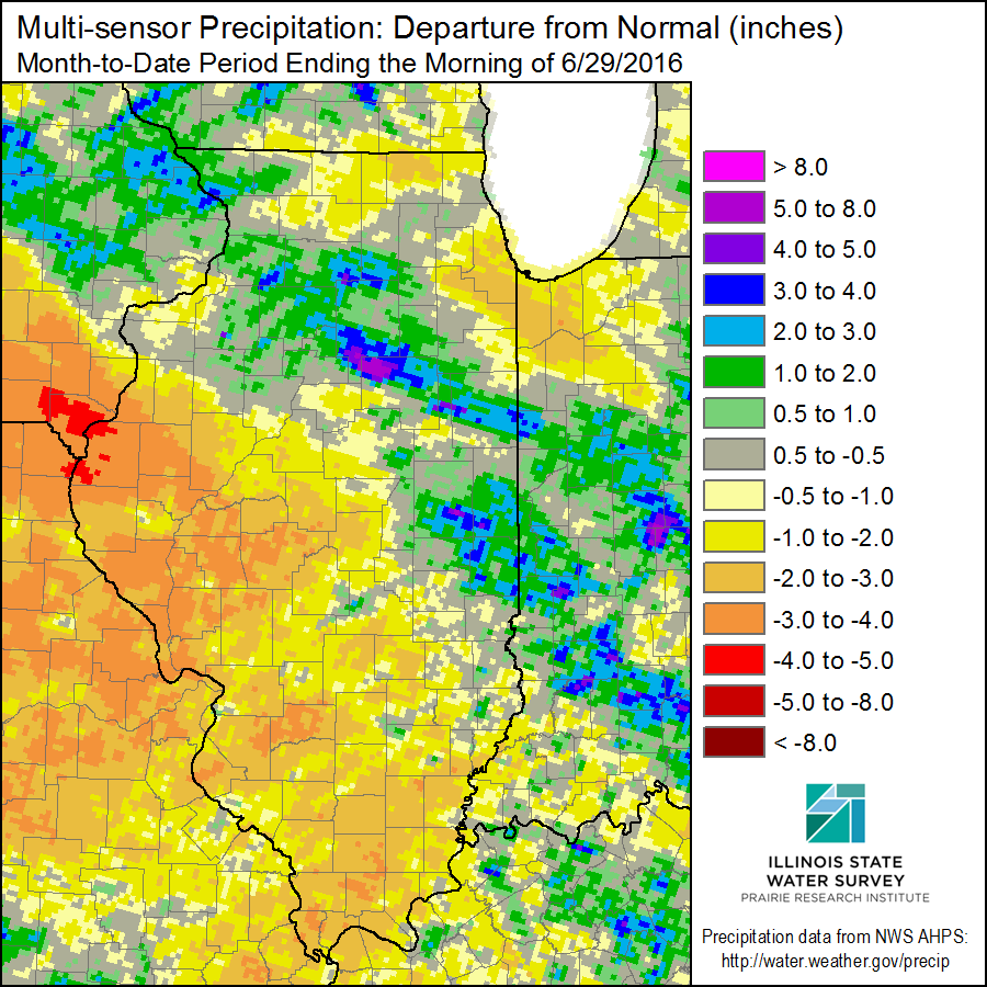
Much of western and southern Illinois has been dry in June. In the first map below, areas in the darker shades of orange are 2 to 4 inches below normal on rainfall for the month. Meanwhile, areas in eastern-central and northern Illinois have been near to above normal. A few areas have been downright wet (shaded in blue). Temperatures have been running 4 to 5 degrees above normal.
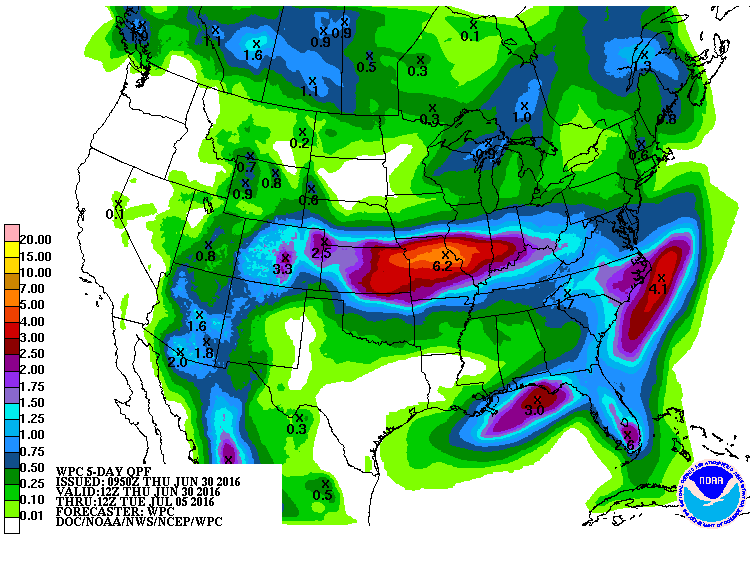
However, this picture could change dramatically with the National Weather Service models indicating that up to 6 inches of rain could potentially fall over the next 5 days (second map). While that area certainly needs rain, it is almost too much of a good thing. Depending on how fast the rain falls, some of it will likely run off instead of having a chance of soaking in.
Here is the 5-day precipitation forecast showing the potential rainfall totals. Areas shaded in red are expected to received between 2.5 and 5.0 inches.