Warmer-than-average December in Illinois

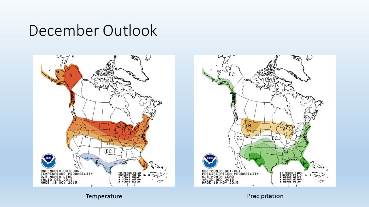
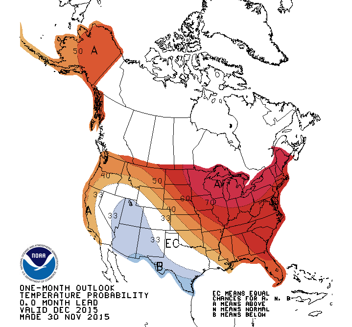
The NWS released their latest forecast for December and it is calling for very strong odds of a warmer-than-average December for Illinois and a large portion of the United States. They put the chances at 70 percent or higher in northern Illinois and the Great Lakes region. The odds are between 60 and 70 percent for the rest of Illinois. Those are about the strongest odds that I have ever seen in a monthly forecast.

This forecast for December is strongly supported by the various forecasts out to 14 days, which are also calling for very strong chances of above-average temperatures.


off15_temp

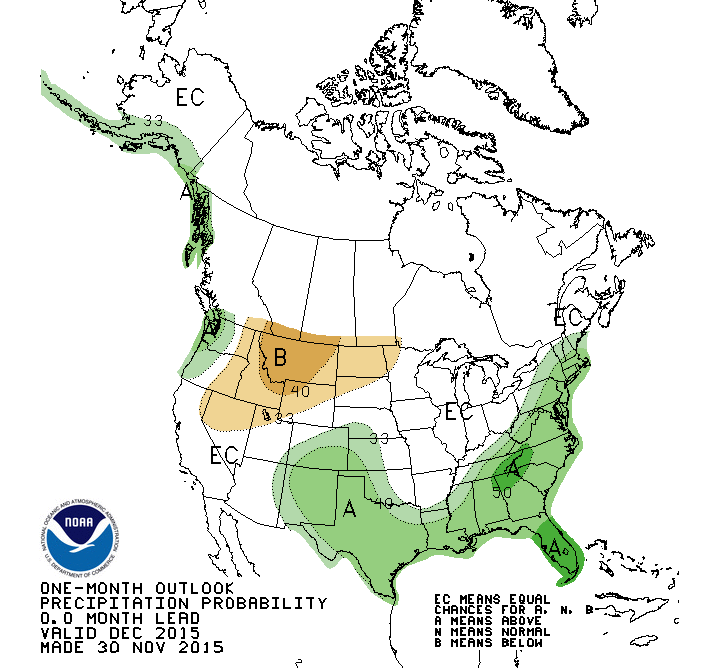
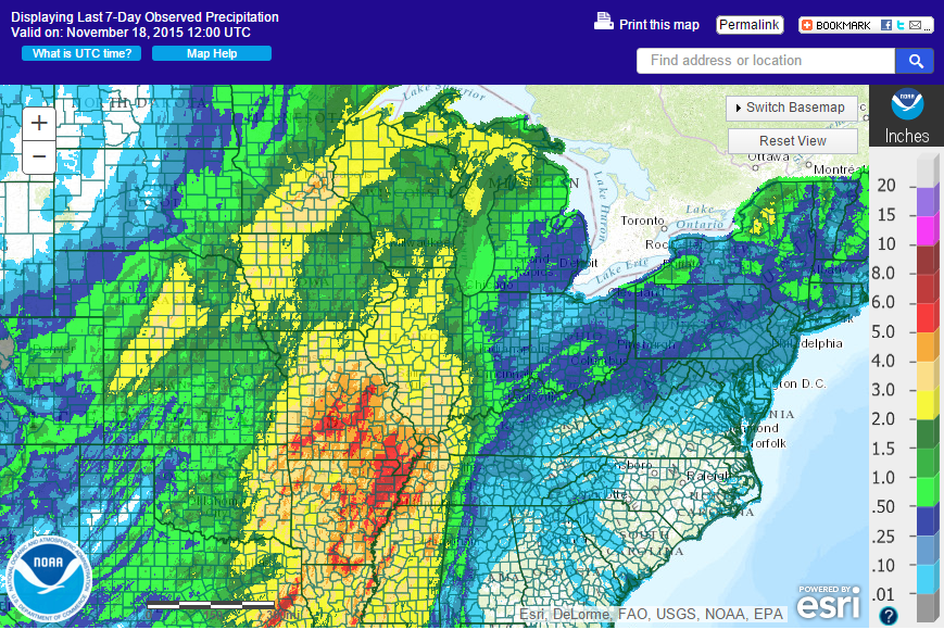
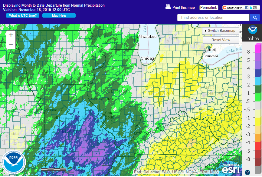
The precipitation forecast is not as striking – increased odds of wetter-than-average conditions in the south and along the East Coast. That’s a classic El Niño precipitation pattern in winter months for those regions.

off15_prcp

Snowfall for November 20-22, 2015

The winter storm over the weekend left a narrow swath of significant snowfall across the central Midwest. The heaviest amounts of 5 or more inches (blue) extended from the High Plains through Iowa, northern Illinois, southern Wisconsin, northern Indiana, and Michigan.

map1

Here is a close-up of Illinois. The largest amounts are along the Illinois-Wisconsin border. Amounts of 5 inches or more (blue) were common across the northern third of the state. The largest snowfall totals in Illinois was 17.1 inches at Roscoe (Winnebago Co.) followed closely by 16.9 inches in Mundelein (Lake Co.). It was the second largest November snowfall for both Chicago (11.2 inches) and Rockford (8.8 inches). See graphics below created by NWS Chicago.

Snowfall amounts tapered off southward, decreasing rapidly from 5 to 1 inches (green), and south of Interstate 70 was essentially snow-free.

map2

ChicagoNovSnowstormsRockfordNovSnowstorms

Winter Forecast

Today the NWS Climate Prediction Center released their forecast for December, winter, and spring. Of course, the strong El Niño in the Pacific Ocean is the dominant player in the forecast. It is expected to remain strong this winter, before transitioning to neutral conditions in late spring/early summer.

In general, over the next six months Illinois will have an increased chance of being warmer than average, while parts of Illinois will have an increased chance of being drier than average. The strongest effects of El Niño will likely be felt in northern states (warmer and drier than average), and in the Southwest and Southeast US (cooler and wetter than average).

December

For December, Illinois has an increased chance of being warmer than average. There is no increased risk of being wetter or drier in December.

Slide1

Winter

For winter, Illinois has an increased chance of being warmer than average. The eastern half of Illinois has an increased chance of being drier than average. The western half of Illinois has no increased chance of being wetter or drier than average.
Slide2.PNG

Spring

For spring, the northern half of Illinois has an increased chance of being warmer than average. The southern half has no additional chance of being warmer or cooler than average. Parts of eastern and northern Illinois have  an increased chance of being drier than average. The rest of the state has no increased chance of being wetter or drier than average.

Slide3.PNG

Rainfall Totals from the Recent Storm

A large, slow-moving low-pressure system passed through the central US this week, bringing widespread rains from Louisiana all the way up the Mississippi River Valley. Areas in yellow and beige received 2 to 4 inches of rain, including large parts of Illinois. Some counties along the Illinois-Indiana border received amounts in the 1 to 2 inch range. Meanwhile, areas in Missouri and Arkansas received 5 to 8 inches.

The largest amount reported in Illinois in the last three days was 3.95 inches in White Hall, IL. White Hall is in Greene County and where my great-grandparents lived.

map1

Here are the rainfall departures for November so far. Areas in green are between half an inch and two inches above average. Areas in blue are two to four inches above average. This should pretty much erase any concerns about dry conditions earlier this fall.

map2

By the way, these maps came from a NWS product at http://water.weather.gov/precip/