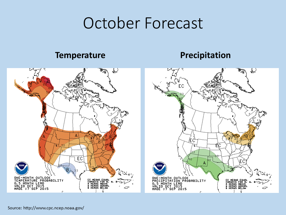
The NWS Climate Prediction Center released their latest outlook for October and beyond. It looks like the warm-than-average weather is expected to continue for the next several months. The primary driver in the forecast is the ongoing El Niño in the Pacific Ocean basin.
October
Illinois has an increased chance of above-average temperatures for October. There is not much to report on precipitation in Illinois. We are between drier-than-average conditions to our northeast and wetter-than-average conditions to our southwest.
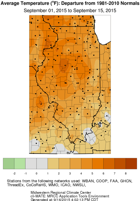
The first half of September in Illinois was warmer than average, about 3.5 degrees above average.
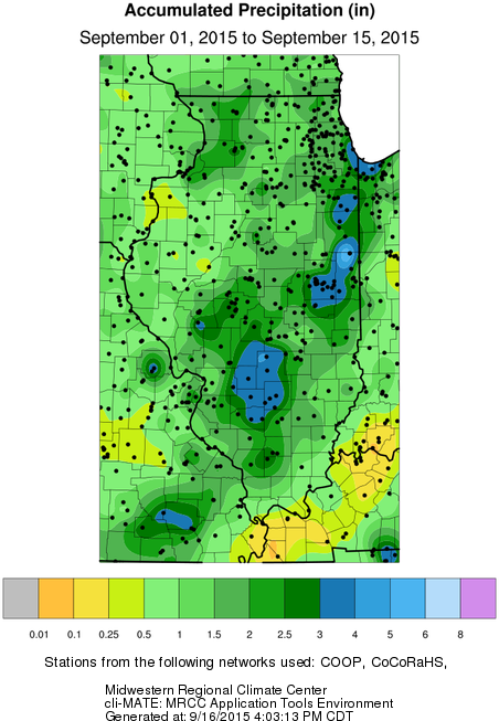
Precipitation for the first half of September is mixed. A few areas east of St. Louis and along the eastern border with Indiana have seen 3 to 4 inches, which is well above average. Much of the rest of the state has seen a respectable 1 to 3 inches. Western Illinois has been drier.
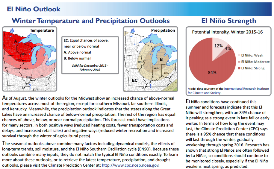
A number of Midwestern regional climate service partners, including state climatologists, regional climate centers, and NOAA offices, put together a two-page fact sheet on El Niño status and impacts in the Midwest.
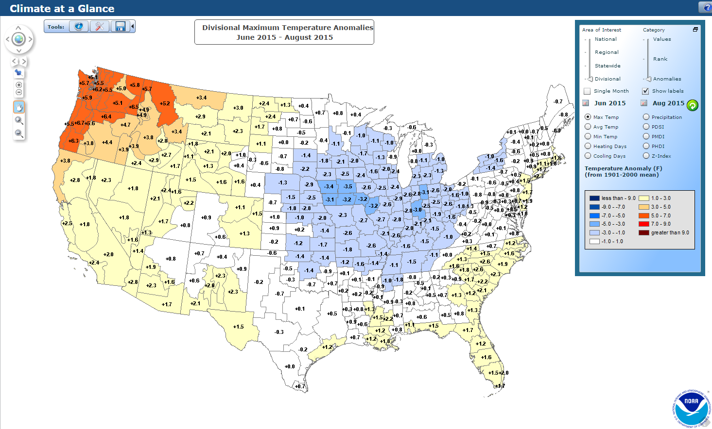
Cooler than average daytime highs (first map, blue shaded areas) and warmer than average night-time lows (second map) this summer were common across much of the Midwest, according to data from the National Centers for Environmental Information.
It is typical in Illinois for this to happen in summer after a wet spring. We marched through summer with above-average soil moisture, streamflows, and lake levels. As a result, more of the sun’s energy went into evaporating this water instead of heating up the land surface and the atmosphere. The end results were higher humidity levels and lower high temperatures.
At night, the higher humidity levels kept temperatures from dropping as much. The old forecasting rule of thumb was to consider the dew-point temperature as the floor to night-time temperatures. Therefore, the higher dew-point temperatures led to higher night-time temperatures.*
Finally, all the extra humidity in the atmosphere turned into more rainfall for thunderstorms, maintaining the wetter conditions through at least July.
Click to enlarge. Cooler than average daytime high temperatures this summer across the Midwest. Source: National Centers for Environmental Information (NCEI).