The post from this morning documented the above-average rainfall received so far in June across Illinois. On top of that, the latest NWS forecasts indicate that wetter-than-average conditions are expected for the rest of June as well as July in Illinois.
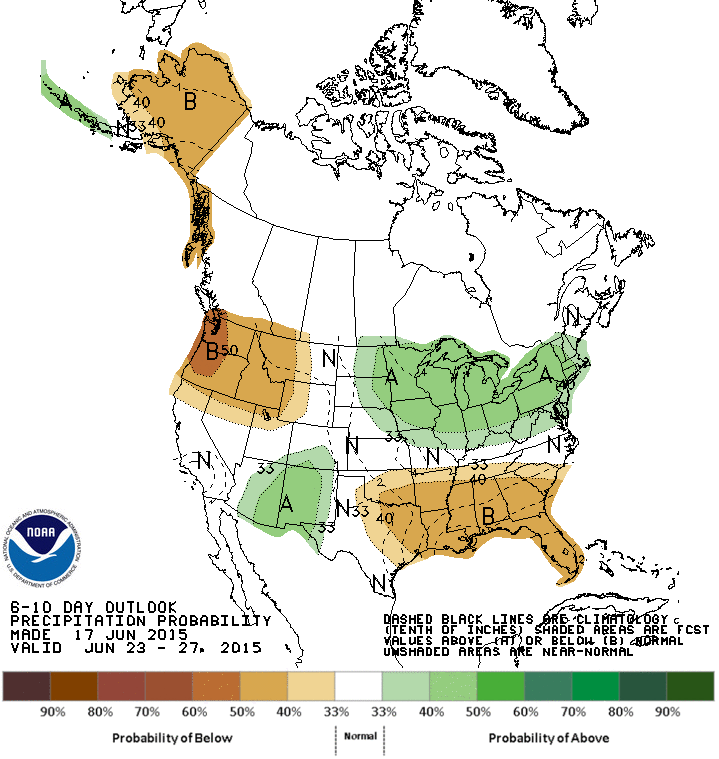
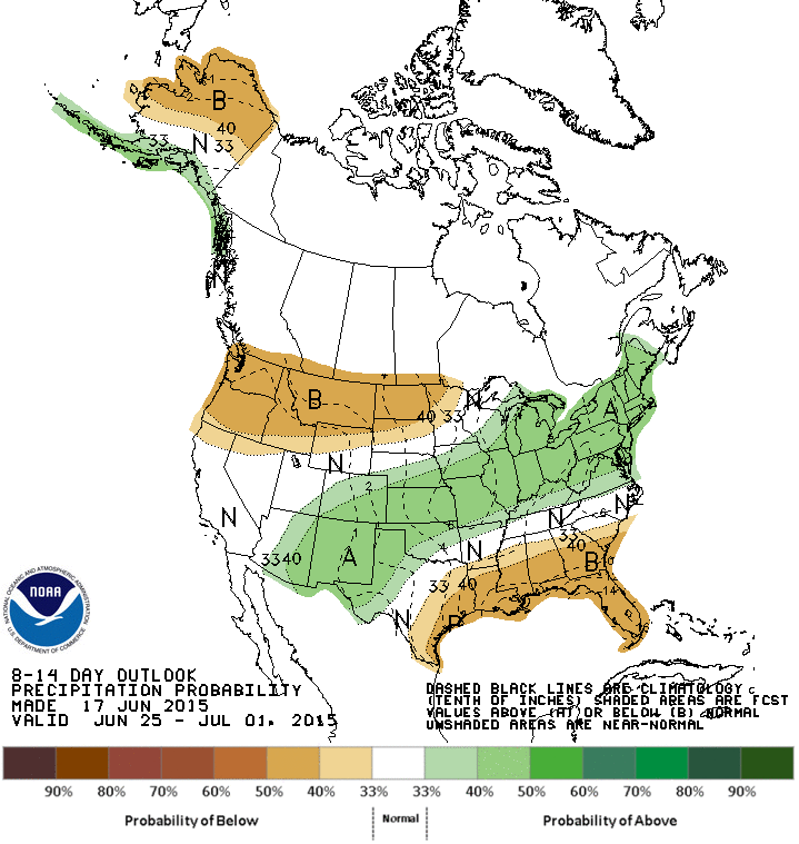
The first map shows the 6-10 day forecast with Illinois and most of the Corn Belt having an increased chance of wetter-than-average conditions. The second map shows the 8-14 day forecast with the same wet pattern.
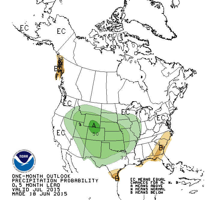
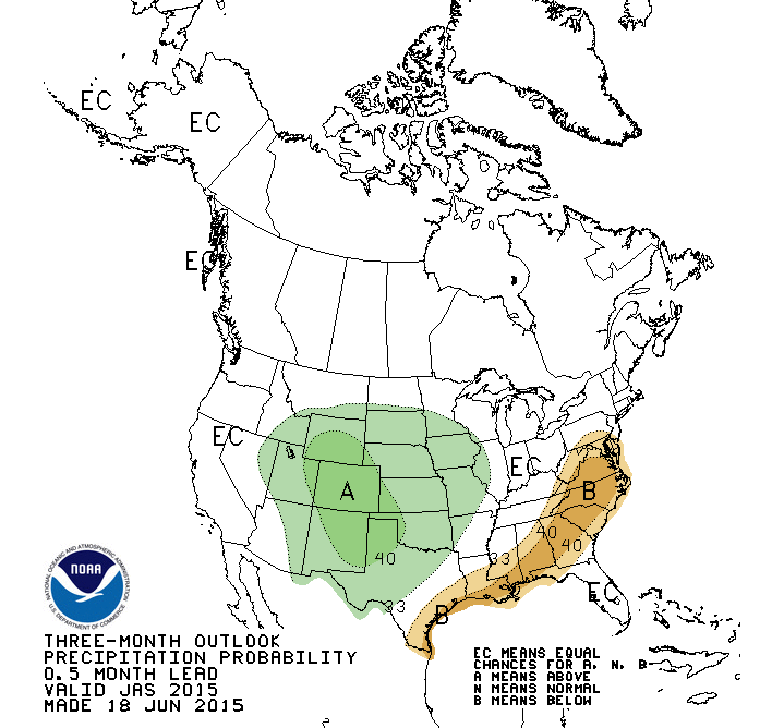
The third map shows the month of July with an increased chance of wetter-than-average conditions across all of Illinois. The fourth map shows the three-month forecast for July-September. At that point, the chance for wetter-than-average conditions is confined to western Illinois.

Jim I don’t have a comment about this post specifically but had a general question for you. In discussing climate change lately with people in Chicago there has been a tendency for people to simply discuss how cool it has been over the last couple years here locally. How best can I explain why temperatures here locally have been down while much of the rest of world is getting warmer. The more succinct and simplistic the better I suppose.
Thank you for your time.