Summary: According to the NWS Climate Prediction Center, El Niño has arrived and has a 90% chance of staying this summer and an 80% chance of remaining through the end of 2015. In terms of strength, this El Niño is expected to be weak to moderate. Illinois is expected to have an increased chance of cooler-than-average conditions in the late summer and on into fall.
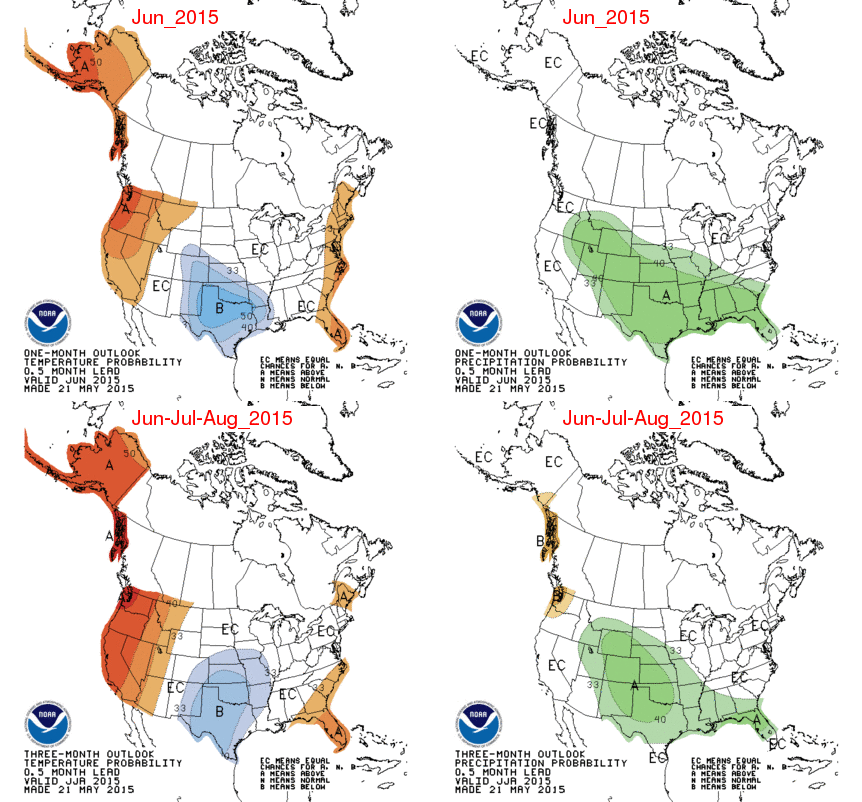
The El Niño event has finally arrived and heavily influenced the NWS climate outlooks released this morning. For June (first figure, top row), the Southern Plains are expected to have an increased chance of cooler-than-average temperatures. A large part of the US is expected to have an increased chance of wetter-than-average precipitation, including the southern two-thirds of Illinois.
For the period June-August (first figure, second row), the increased chance for cooler-than-average conditions stretches northward and eastward and includes far western Illinois. The increased chance for wetter-than-average conditions does not cover Illinois. This should not be a concern since no part of Illinois is in drought now.
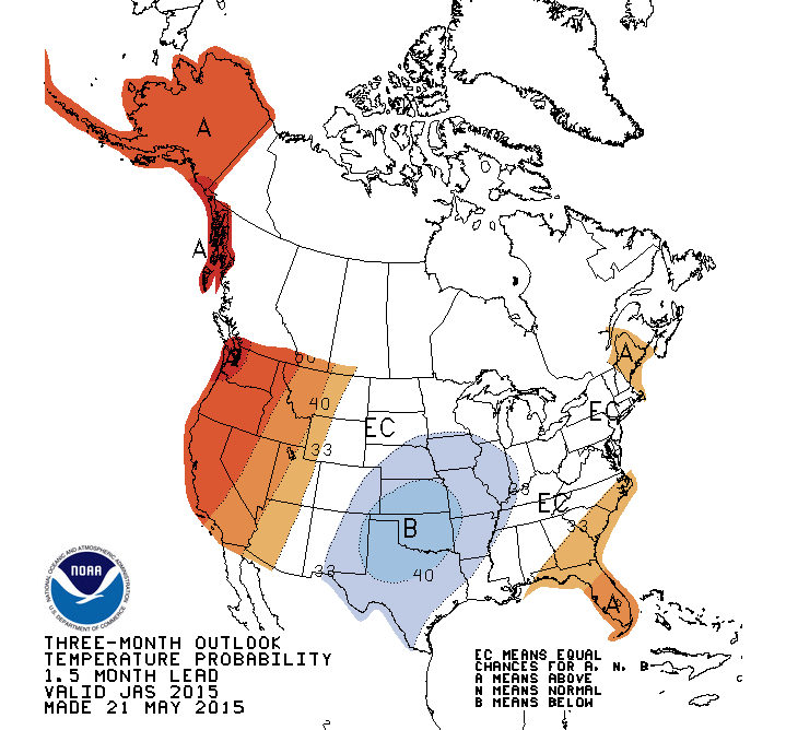
Later forecasts for July-September, August-October, and September-November show in increased chance of cooler-than-average across Illinois (see second figure for the July-September temperatures).
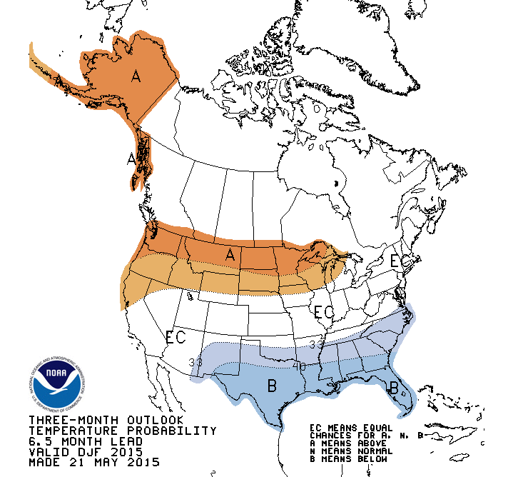
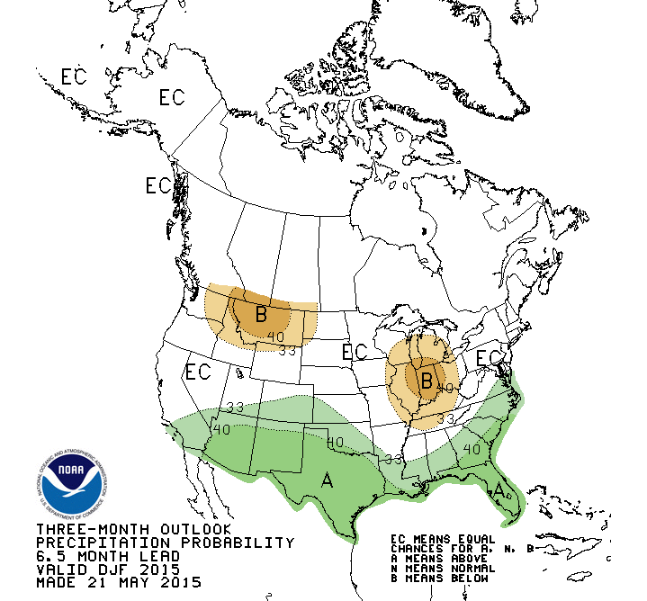
Finally, the forecast for December-February shows that the northern states have an increased chance of warmer-than-average conditions. Illinois is just outside that region. (see third figure). There is an increased chance for drier-than-average conditions across Illinois and surrounding states (last figure).