
Today the NWS Climate Prediction Center has released their latest outlook for November and this winter. Below are the maps for November temperature, November precipitation, December-February temperature, and December-February precipitation.
For Illinois, November temperatures have equal chances (EC) of being above, below, or near-average. November precipitation is rated as EC except for the northeast quarter of the state, which has an increased chance of below-average precipitation. This is part of a larger area with increased chances of below-average precipitation across the Great Lakes region.
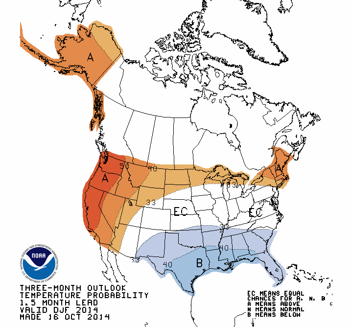
The category of EC is a little hard to interpret. Basically, it means that there are no consistent indications that conditions could be too warm/cold/wet/dry. Sometimes I call it a neutral forecast.
For December-February, the traditional winter months, Illinois has equal chances (EC) of above, below, and near-average temperatures. However, Illinois has an increased chance of below-average precipitation.
Last month’s outlook showed had Illinois with an increased chance of above-average temperatures this winter, but they switched that out this month. I believe this is due to the fact that El Niño has yet to arrive and is expected to be weak if it does arrive. I think the official winter forecast from the NWS will roll out next month.


0 Replies to “NWS Outlook for November and Winter”