It is no surprise that June has turned into a wetter-than-average month. The statewide precipitation in Illinois is sitting at 6.1 inches, 1.9 inches above average. Several locations in central and northern Illinois have reported rainfall totals in the 8 to 10 inch range. Two of the highest so far are Dixon (IL-LE-17) with 10.15 inches and Galena (IL-JD-2) with 10.12 inches. We will have the final statistics on June next week.
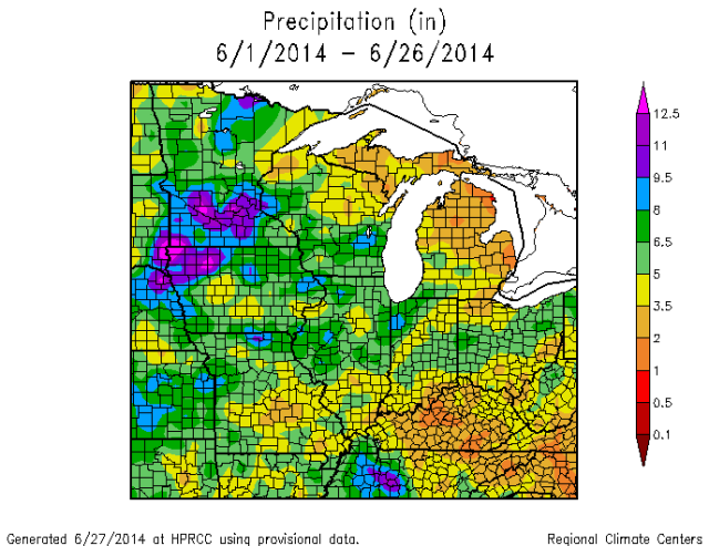
As the map below shows, areas in green and blue are in the 5 to 12 inch range, and are common across central and northern Illinois, as well as northern Missouri, Iowa, Minnesota, southern Wisconsin, and parts of Indiana.
Of course, lots of rain means lots of runoff and flooding. Most of the rivers and streams in Illinois and the Midwest are having relatively high flows, shown by this USGS map. The green dots show flow in the normal range, blue dots indicate above normal flow, and black dots are record flows for this date.
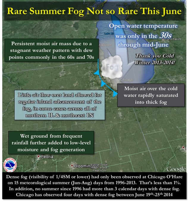
Finally, the Chicago area has not only struggled with heavy rainfall events that have caused flooding in June, but they have had an unusually high number of days with fog. Here is the web page from the Chicago NWS office explaining what is going on with this fog.


