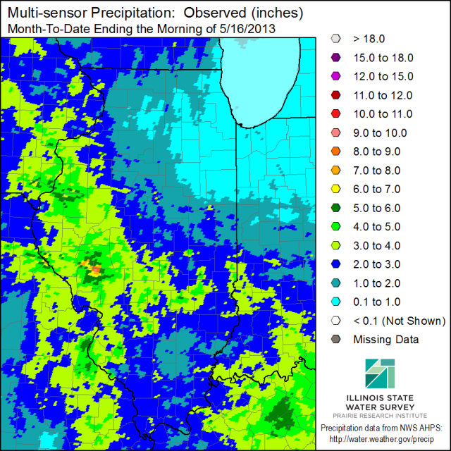
Here is the latest map of May precipitation in Illinois through the morning of May 16, showing the generally wetter conditions in western Illinois and parts of southern Illinois. Amounts were on the order of 3 to 6 inches with a few heavier amounts around White Hall. Areas in the southeast, east-central and much of northern Illinois were drier with amounts of 0.5 to 2 inches common.
There was a strong relationship between temperature and precipitation this month (second figure). Areas with heavier rainfall amounts (western and southwestern IL) had temperatures 2 to 4 degrees below average. Meanwhile areas in east-central and northern Illinois had temperatures near to slightly above average.

New NWS Outlooks for June and June-August
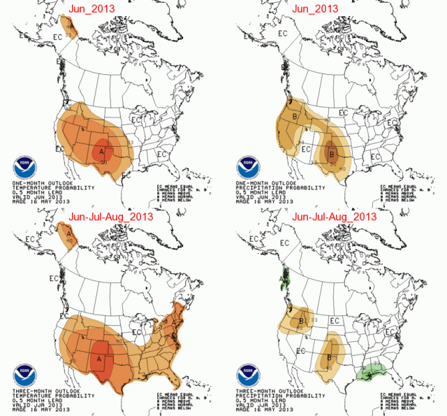
Today, the NWS Climate Prediction Center released their temperature and precipitation outlooks for June and June-August and beyond. You can see their full suite of outlooks here.
There isn’t much to report for Illinois (below). We are in the EC zone which means we have equal chances of above, below, and near-average temperatures and precipitation for the next three months. The only exception is that far southern Illinois has a slightly higher chance of above-average temperatures for June-August.
All Quiet on the Severe Weather Front
As of May 8, 2013, the severe weather statistics for Illinois this year are relatively low (see first map). There have been 2 tornado reports (red dots), 25 hail reports (green dots), and 62 wind damage reports (blue dots). By this point last year, we had 22 tornadoes including the deadly February 29 tornado at Harrisburg, IL, that killed 8 people.
Harold Brooks of the NWS has an interesting post on the current “tornado drought” in the US for the period from May 2012 to April 2013. He says,
The 12-month period from May 2012 to April 2013 was remarkable for the absence of tornado activity and tornado impacts in the United States.
The number of tornadoes in the US was the lowest on record (197) and the number of deaths (7) was the second lowest during this 12-month period. Brooks’ looked at tornadoes that were rated EF-1 or greater. Those tornadoes tend to be better documented over time than the relatively weak EF-0 events. Those records go back to 1954. The number of tornado deaths were based on records going back to 1875.
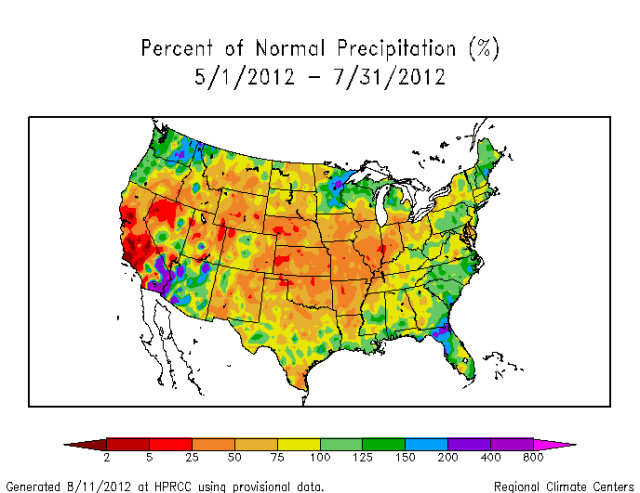
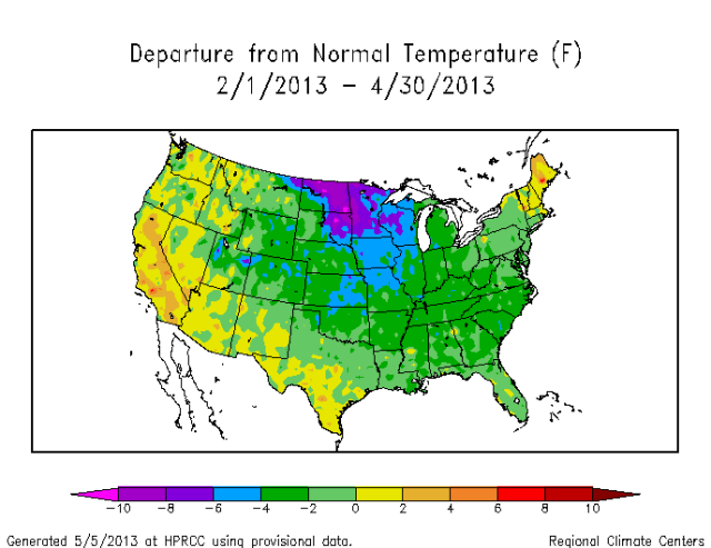
A possible explanation for the low numbers during this May 2012 to April 2013 period was that much of the central US was in drought in 2012 (see second map). This was followed by a late, cold spring in 2013 (see third map). Both of these conditions seem to produce fewer severe thunderstorms, at least in Illinois.
There has been lots of discussion about whether the low numbers this year or the high numbers in 2011 either prove or disprove climate change. It is hard to track historical climate changes in the tornado reports in Illinois and the US because of major changes in how the data were collected over time. Furthermore, climate models used for understanding future climate change are not designed to simulate severe weather at such a small scale. As a result, the Intergovernmental Panel on Climate Change last year stated there was “low confidence” in finding historical trends or making projections of possible future tornado activity (IPCC, 2012 pdf). You can find a short discussion on historical tornado trends in Illinois on my website.
While these are interesting statistics, it’s important to keep in mind that things can change in a hurry. All it takes is one day with the right conditions, especially now that we are finally getting warmer, and Illinois could be faced with another tornado outbreak. Stay alert!

Heavy Rains Hit Western and Southwestern Illinois
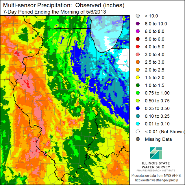
[updated to show Midwest 7-day rainfall map] Over the last 7 days a slow-moving system produced heavy rains over western and southwestern Illinois. The first map for Illinois below is based on the highly detailed radar-estimated precipitation that has been calibrated with available rain gauges. The rains decreased eastward with the lowest totals in the northeast. The largest station total in Illinois was at La Harpe with 4.17 inches. Several nearby stations had totals of just under 4 inches.
Illinois was not the only state to experience heavy rains. The second map shows that substantial rains fell across much of Missouri, Iowa, southeast Minnesota, and western Wisconsin. To the east of Illinois, heavy rains fell in southern Indiana and almost all of Kentucky.
If last year was the year of the drought, I think this year can be called the year of the anti-drought.
