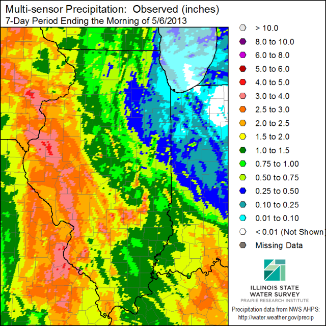
[updated to show Midwest 7-day rainfall map] Over the last 7 days a slow-moving system produced heavy rains over western and southwestern Illinois. The first map for Illinois below is based on the highly detailed radar-estimated precipitation that has been calibrated with available rain gauges. The rains decreased eastward with the lowest totals in the northeast. The largest station total in Illinois was at La Harpe with 4.17 inches. Several nearby stations had totals of just under 4 inches.
Illinois was not the only state to experience heavy rains. The second map shows that substantial rains fell across much of Missouri, Iowa, southeast Minnesota, and western Wisconsin. To the east of Illinois, heavy rains fell in southern Indiana and almost all of Kentucky.
If last year was the year of the drought, I think this year can be called the year of the anti-drought.


