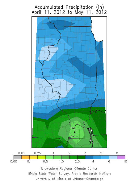
A more active weather pattern has brought much needed rains to most of central and northern Illinois over the past two weeks. In fact, the 30-day rainfall totals and departures from normal look better (see Figures 1 and 2 below). Areas north of Interstate 70 have received between 4 and 8 inches of rain between April 11 and May 11. In many cases, that is between 1 and 3 inches above normal. In those areas, soil moisture and stream flows have responded positively to the rains.
As a result, the US Drought Monitor has changed the “moderate drought” area in central Illinois to “abnormally dry” and the previous “abnormally dry” area to near-normal conditions. See Figure 3.
Rainfall amounts south of Interstate 70 have been low and decrease southward from 3 to 1 inches. That works out to be 1 to 3 inches below normal. This area of dryness is tied into a larger problem area that includes southeast Missouri, western Kentucky, and Tennessee.


