 Illinois has just come off its third warmest winter on record. And the warm weather continues in March. The first 7 days have been 3.2 degrees above normal and the NWS forecast for the next 14 days shows high odds of above-normal temperatures.
As a result, plants have begun to think spring is here. On the left are some daffodils in my yard in Champaign today. The blooms are just about to open. It’s the same story for the Magnolia tree at work (picture right). And this is central Illinois. Southern Illinois will be even farther along than here.
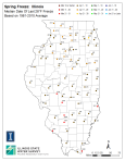
 So what’s the problem? Well, it’s March 8 and we could still have temperatures drop into the 20s in March and April. In fact the median date for the last 28 degree reading in spring in Illinois somewhere near early to mid April in most locations. Our GIS expert Zoe produced this map (left) of the median dates in spring. Click the thumbnail to enlarge.
April Freeze of 2007
An April freeze is exactly what happened in 2007. A warm March was followed by a cold-air outbreak on Easter weekend that caused temperatures to drop into the low 20s and produced high winds.
Below is the plot of the daily average temperature from March 1 to April 30, 2007, for Illinois. There was a small stretch of warm temperatures in early March and then a long stretch in late March and early April with temperatures 10 to 20 degrees above normal. Trees and shrubs rapidly sprouted tender leaves and flowers during this warm spell. Things took a turn for the worst in early April when temperatures plummeted to 10 to 20 degrees below normal for about 2 weeks.

That particular freeze cause over a billion dollars in damages across the Midwest and Southern U.S. to fruit crops, especially apples and peaches, as well as alfalfa and winter wheat. Here are some reports that outlined the conditions and damages.
- Report on the Easter Freeze of 2007 in Illinois (pdf)
- NOAA Technical Report on the Easter Freeze of 2007 across the central US (pdf)
- National Climatic Data Center webpage on the 2007 Freeze

